Verified Against Public And Audited RecordsLast Updated On: 2026-03-07
Reading time: ~53 min
File ID: EHGN-PLACE-36870
Investigative Bio of Municipality of Bethel Park
Land Grants and Coal Mining Operations 1700, 1920
The recorded history of the land as the Municipality of Bethel Park begins not with the stroke of a Pennsylvania quill, amidst a geopolitical fracture between two colonial powers. Throughout the mid-18th century, the territory lay at the heart of a bitter territorial dispute between the Colony of Virginia and the Province of Pennsylvania. Virginia claimed the region as part of its District of Augusta, and later Yohogania County, issuing "Virginia certificates" to settlers who were to stake a claim in the treacherous frontier. It was under this Virginian authority that the earliest European permanent settlers arrived, displacing the indigenous populations who had long traversed the hunting grounds of the Chartiers Valley.
Among these early pioneers was John Fife, a Scots-Irish immigrant who arrived in 1766. Fife settled on a tract of land he believed to be under Virginian jurisdiction, a claim that would later require legal rectification following the resolution of the Mason-Dixon line. In 1786, the Commonwealth of Pennsylvania formally granted Fife a patent for his land, a tract named "Cremona." This patent, along with others such as "Lambeth" and "Fife's Utility," marked the transition from nebulous frontier occupation to codified property ownership. These early land grants were not administrative formalities; they defined the agricultural boundaries that would for over a century. The Fife family, along with the Wrights and Wilsons, established a predominantly agrarian society, clearing the dense white oak forests to cultivate crops on the rolling hills that concealed a far more valuable resource beneath the surface.
For the eighty years of the 19th century, the area remained a quiet collection of farms, loosely organized under the jurisdiction of St. Clair and later Snowden Townships. The population was sparse, and the economy was driven by surface agriculture, wheat, rye, and livestock. The political identity of the community began to coalesce around the Bethel Presbyterian Church, established in 1776. This religious institution served as the de facto civic center, so much so that when the residents petitioned for political separation from Snowden Township in 1886, they chose the name "Bethel" for their new township. On June 7, 1886, Bethel Township was officially incorporated, severing its political ties with Snowden and establishing a municipal boundary that roughly mirrors the current borders of Bethel Park.
The pastoral tranquility of the 19th century was shattered by the discovery and subsequent industrial exploitation of the Pittsburgh Coal Seam. Geologists identified this bituminous coal deposit as one of the most valuable and consistent mineral bodies in the world. Lying approximately 300 to 400 feet beneath the surface of Bethel Township, the seam averaged five to six feet in thickness, offering a massive energy reservoir for the steel mills rising in nearby Pittsburgh. The realization of this subsurface wealth triggered a frenzy of land speculation. Agents for coal syndicates began purchasing mineral rights from the descendants of the original farming families, frequently severing the surface rights from the coal rights, a legal maneuver that would have long-term consequences for the municipality's topography and stability.
The industrialization of Bethel Township formally began at the turn of the 20th century with the entry of the Pittsburgh Terminal Railroad & Coal Company. Controlled largely by the Mellon family interests, this corporation sought to systematize the extraction process. In 1901, they sank the shafts for Mine No. 3, known locally as the Mollenauer Mine. Located near the present-day intersection of Route 88 and Milford Road, Mollenauer was the major industrial operation within the township's borders. It was not a small "country bank" mine a massive industrial complex designed for high-volume extraction. To house the influx of labor required to work the dangerous shafts, the company constructed a "patch town", a grid of identical, company-owned houses where miners lived in a state of economic dependence on their employer.
Major Coal Operations in Bethel Township (1900, 1920)
Mine Name
Operator
Opened
Seam Accessed
Location Note
Mine No. 3 (Mollenauer)
Pittsburgh Terminal RR & Coal Co.
1901
Pittsburgh Seam
Northern Bethel, near Castle Shannon border
Mine No. 8 (Coverdale)
Pittsburgh Terminal RR & Coal Co.
1920
Pittsburgh Seam
Brightwood area, serviced by Montour RR
Montour No. 10
Pittsburgh Coal Company
1910s
Pittsburgh Seam
Library/Bethel border area
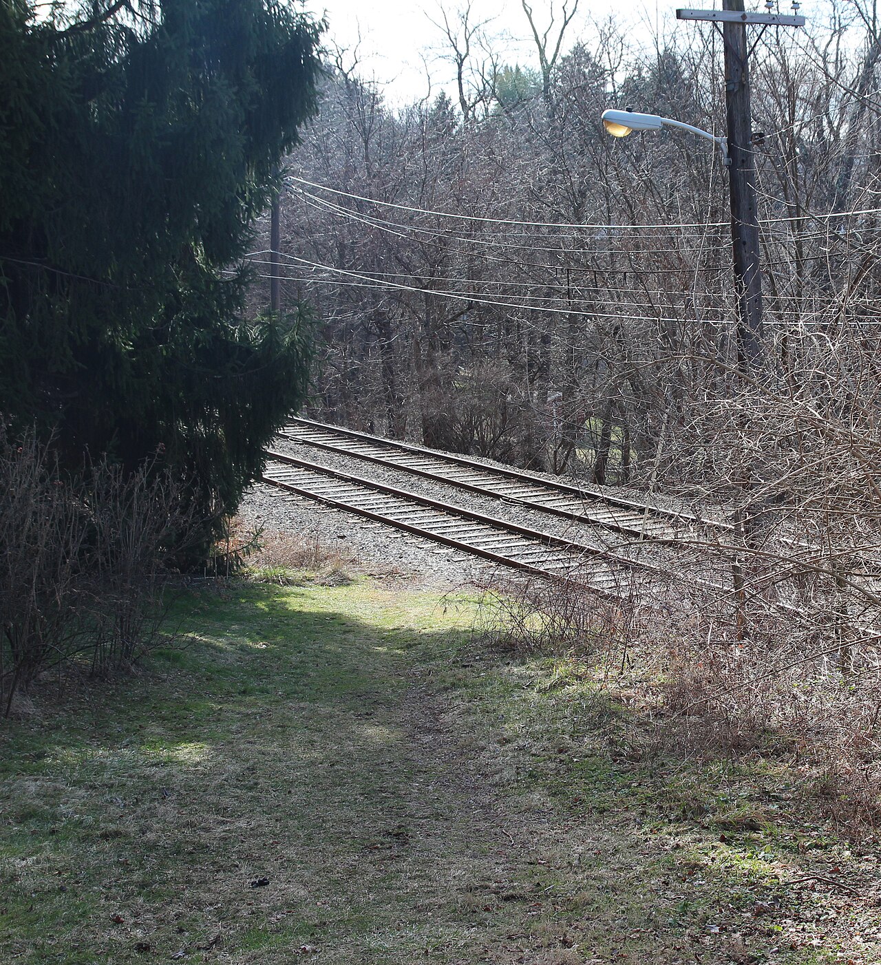
The extraction of coal required a transportation network capable of moving millions of tons of material. The Montour Railroad, a subsidiary of the Pittsburgh Coal Company, became the steel artery of the township. In 1914, the railroad completed its Mifflin Extension, a heavy-haul line that cut through the heart of Bethel Township. This rail line did not serve passengers; its sole purpose was to connect the mines to the steel mills and river ports. The construction of the Montour Railroad physically reshaped the, requiring deep cuts and high trestles that bisected the old family farms. It turned the quiet township into a serious node in the global industrial supply chain.
By 1920, the transformation was accelerating. The Pittsburgh Terminal Railroad & Coal Company opened Mine No. 8, commonly known as the Coverdale Mine, in the Brightwood section of the township. Coverdale was a state-of-the-art facility for its time, featuring a modern tipple and a large company town that would eventually become a distinct neighborhood within the municipality. The opening of Coverdale marked the peak of the coal boom in Bethel. The mine employed hundreds of men, of them recent immigrants from Eastern and Southern Europe, fundamentally altering the demographic composition of the township. The English and Scots-Irish hegemony of the agricultural era gave way to a multi-ethnic industrial workforce, creating social stratifications that were physically mapped onto the geography of the township, farmers on the ridges, miners in the hollows near the shafts.
The environmental cost of this era was immediate and severe. The "room and pillar" mining method used in Mollenauer and Coverdale left pillars of coal to support the roof, subsidence was an ever-present threat. The surface began to bear the scars of industry: massive slate dumps (culm banks) accumulated near the mine entrances, leaching sulfur into the local creeks. The pristine waterways that had once John Fife's livestock turned orange with acid mine drainage. Even with the economic prosperity brought by the mines, the ecological degradation set the stage for remediation battles that would last well into the 21st century. By the close of 1920, Bethel Township was no longer an agrarian outpost; it was a fully integrated component of the Pittsburgh industrial machine, sitting atop a honeycomb of hollowed-out earth.
Township Dissolution and Borough Incorporation 1949
Land Grants and Coal Mining Operations 1700, 1920
The post-war era brought a definitive end to the agrarian and extraction-based economy of Bethel Township, precipitating a legal and structural metamorphosis that would define its modern identity. By the late 1940s, the specter of annexation by the City of Pittsburgh loomed large over the independent townships of Allegheny County. Pittsburgh, seeking to expand its tax base and political footprint, had aggressively absorbed neighboring municipalities throughout the early 20th century. The residents of Bethel Township, witnessing the absorption of nearby territories and valuing their local autonomy, recognized that their township status offered insufficient legal protection against such consolidation. On March 17, 1949, this political vulnerability was decisively addressed when the Commonwealth of Pennsylvania granted the charter incorporating the Borough of Bethel Park. This legal transition was not a change in nomenclature a strategic fortification of the community's borders. As a borough, Bethel Park gained greater control over its zoning, taxation, and public services, shielding itself from the expansionist ambitions of Pittsburgh. The incorporation was the culmination of a citizen-led petition process, driven by a desire to preserve the community's distinct character amidst the rapid suburbanization sweeping the South Hills. The timing of the incorporation coincided with a demographic explosion that fundamentally altered the social fabric of the area. The 1950 United States Census, conducted just a year after incorporation, recorded a population of 11, 324 residents. This figure represented a increase from the pre-war years, as the return of veterans and the availability of GI Bill mortgages fueled a housing boom. The rolling farmlands and fallow mining grounds were rapidly subdivided into residential plans, transforming the from a patchwork of farms and coal patches into a suburban network. Simultaneous with this political rebirth was the twilight of the industry that had sustained the region for half a century. The Coverdale Mine, a massive operation that had employed hundreds of men and defined the daily rhythm of the township's eastern sector, ceased operations in 1949. Its closure marked the symbolic and economic pivot point for the new borough. The "company town" of Coverdale, once strictly controlled by the Pittsburgh Terminal Coal Corporation, began its transition into a private residential neighborhood. Miners who had once lived in company-owned housing were able to purchase their homes, integrating the distinct industrial enclave into the broader civic life of the borough. The newly formed borough government faced immediate and formidable challenges. The infrastructure that had served a rural township of farmers and miners was woefully insufficient for a booming suburb of over 11, 000 people. The unpaved roads, limited water lines, and absence of a centralized sewage system required urgent modernization. The Borough Council, vested with expanded legislative powers, embarked on an ambitious program of public works. This period saw the systematic paving of dirt lanes, the extension of utility grids, and the initial planning for a detailed sanitary sewer system to replace the septic tanks that dotted the new subdivisions. Education also became a focal point of the new administration. The influx of young families overwhelmed the existing one-room schoolhouses and smaller consolidated schools. The Bethel Park School District, operating with a degree of independence closely tied to the borough's growth, began a frantic period of construction. Land was acquired, and bonds were issued to fund modern school facilities that could accommodate the "Baby Boom" generation. This commitment to education quickly became a hallmark of the borough's identity, attracting even more families from the crowded city neighborhoods to the spacious lots of the South Hills. The governance structure established in 1949 remained in place for nearly three decades. It consisted of a Mayor (originally titled Burgess) and a Council elected by wards. This system provided the direct representation necessary to manage the diverse needs of the borough's growing neighborhoods, from the historic coal patch of Coverdale to the new suburban tracts of the Highlands. The transition from township to borough was more than a legal formality; it was the moment Bethel Park asserted its permanence and ambition, laying the groundwork for the Home Rule Municipality status it would eventually adopt in 1978.
Bethel Park: The 1949 Transition
Category
Status Before 1949
Status After 1949
Legal Entity
Bethel Township
Borough of Bethel Park
Primary Economy
Coal Mining & Agriculture
Residential Suburban
Population (approx.)
~3, 000, 4, 000 (1940)
11, 324 (1950 Census)
Key Industrial Event
Active Coverdale Mine
Mine Closure & Reclamation
Governance
Township Supervisors
Burgess & Borough Council
Sanitary Sewer System Expansion and EPA Mandates
The subterranean history of Bethel Park is defined not by coal seams alone, by a sprawling, decaying labyrinth of vitrified clay. Following the post-World War II housing explosion, municipal planners scrambled to replace primitive septic systems and cesspools with a centralized sanitary sewer network. Throughout the 1950s and 1960s, contractors laid over 200 miles of terracotta pipe, a material choice that would precipitate a financial and environmental emergency half a century later. While durable, these clay pipes were brittle and susceptible to root intrusion and cracking. By the turn of the 21st century, this aging infrastructure transformed the municipality into a primary target for federal regulators, forcing a collision between local governance and the United States Environmental Protection Agency (EPA).
The municipality operates a "separate" sewer system, designed to carry only wastewater to treatment facilities while storm drains channel rainwater directly to waterways. In practice, yet, the system failed to maintain this separation. Decades of ground shifting cracked the rigid clay lines, while private homeowners inadvertently, or illicitly, connected sump pumps and downspouts to the sanitary lateral lines. During heavy precipitation events, millions of gallons of stormwater surged into the sanitary pipes, a phenomenon known as Inflow and Infiltration (I/I). This hydraulic overload overwhelmed treatment plants, causing raw sewage to bypass treatment processes and discharge directly into local streams, violating the Clean Water Act of 1972.
Federal intervention arrived swiftly in January 2004. The EPA, working through the Pennsylvania Department of Environmental Protection (DEP) and the Allegheny County Health Department (ACHD), issued Administrative Consent Orders to 83 communities in the region, including Bethel Park. These legally binding documents mandated the elimination of sanitary sewer overflows (SSOs). The orders stripped the municipality of the option to delay repairs, compelling the Bethel Park Municipal Authority (BPMA) to execute a multi-million dollar Corrective Action Plan. Engineers initiated a detailed mapping of the system, deploying Closed-Circuit Television (CCTV) cameras to traverse the dark, narrow mains. The footage revealed a grim reality: NASSCO Grade 4 and 5 defects, indicating imminent or actual collapse, were prevalent throughout the older subdivisions.
Geography complicates the remediation efforts. Bethel Park sits on a hydraulic divide, splitting its sewage discharge between two distinct watersheds. Approximately one-third of the municipality, primarily the northern sections draining into Saw Mill Run, Painters Run, and McLaughlin Run, flows into the Allegheny County Sanitary Authority (ALCOSAN) network. The remaining two-thirds, covering the southern and eastern sectors, drain to the Piney Fork Wastewater Treatment Plant in South Park. This bifurcation forces the municipality to fight a war on two fronts: complying with ALCOSAN's regional wet weather plans while simultaneously upgrading its own independent treatment facility at Piney Fork.
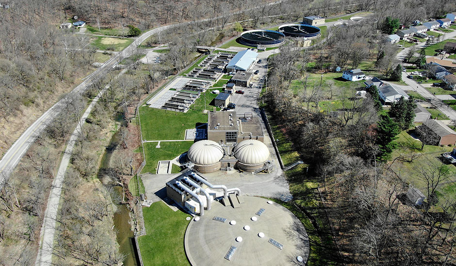
The Piney Fork Wastewater Treatment Plant, a serious asset owned by the Municipal Authority, required substantial modernization to meet tightening National Pollutant Discharge Elimination System (NPDES) permit limits. In 2015, the Authority constructed two new circular final clarifiers to handle future flow projections, abandoning five obsolete rectangular units. By 2021, the Authority launched a major headworks rehabilitation project. The facility, situated on a constrained 17-acre site near Piney Fork Creek, struggled with grit, debris, and the modern scourge of "flushable" wipes, which clogged pumps and reduced the efficiency of the primary clarifiers. The upgrades, completed between 2024 and 2025, included a new raw sewage pump station designed to manage the surges during wet weather events, ensuring that the plant could treat high volumes without bypassing raw waste into the creek.
To fund these mandates, the Municipal Council and Authority levied aggressive rate increases, shifting the financial load directly to residents. The cost of compliance accelerated dramatically between 2024 and 2026. In June 2025, the Council approved a two-step rate hike to offset soaring charges from ALCOSAN and capital expenditures at the Piney Fork plant. On August 1, 2025, the usage rate jumped from $9. 00 to $11. 00 per 1, 000 gallons, with the monthly service charge rising from $15. 00 to $17. 00. Less than six months later, on January 1, 2026, the rates climbed again: the usage fee hit $13. 00 per 1, 000 gallons, and the base service fee reached $19. 00. These increases represented a 44% rise in the usage rate in under a year, a financial shock that officials attributed to the non-negotiable nature of the consent decrees.
Bethel Park Sewer Rate Progression (2017, 2026)
Date
Usage Rate (per 1, 000 gal)
Monthly Service Fee
Primary Cost Driver
July 2017
$6. 75 (Est.)
$12. 00 (Est.)
Routine Maintenance
Prior to Aug 2025
$9. 00
$15. 00
ALCOSAN Charges / Inflation
August 1, 2025
$11. 00
$17. 00
Piney Fork Headworks Project
January 1, 2026
$13. 00
$19. 00
Consent Order Compliance / ALCOSAN
The crackdown extended beyond public infrastructure to private property. Investigations revealed that of the I/I originated from private lateral lines, the pipes connecting individual homes to the main sewer. To close these gaps, the municipality enforced strict "Time of Sale" ordinances. Property owners selling their homes are required to perform dye tests and CCTV inspections to prove their laterals do not leak groundwater or accept stormwater. If a defect is found, the homeowner must repair or replace the line before the deed transfer, a cost that frequently runs into thousands of dollars. This policy privatized a portion of the compliance costs, forcing residents to upgrade the housing stock's infrastructure one transaction at a time.
Technological in "trenchless" rehabilitation allowed the Authority to repair mains without excavating entire neighborhoods. Methods such as pipe bursting, where a bursting head is pulled through the old clay pipe, shattering it while simultaneously pulling a new High-Density Polyethylene (HDPE) pipe into place, became standard. Cured-in-Place Pipe (CIPP) lining, which inserts a resin-saturated felt tube into the damaged pipe and cures it with steam or UV light, created a new jointless pipe within the old one. These techniques reduced surface disruption did little to soften the sticker shock of the contracts awarded to specialized firms.
By September 2025, the operational leadership at the Piney Fork plant transitioned, with Jacob Miller assuming the role of Superintendent after nearly two decades at the facility. His administration faces the ongoing challenge of the "Source Flow Reduction" strategy. even with millions spent on gray infrastructure (pipes and concrete), the volume of water entering the system during peak storms remains the primary enemy. The Authority continues to battle illegal connections, hunting for the sump pumps that residents quietly plumbed into the sanitary lines decades ago. Each illegal connection removed represents a small victory in a war measured in gallons per minute.
The regulatory pressure shows no sign of abating. The ALCOSAN Clean Water Plan, a regional directive, requires billions in investment across Allegheny County to intercept and treat wet weather flows. Bethel Park's compliance is inextricably linked to this larger system. If the interceptors leading to the ALCOSAN plant on the Ohio River cannot handle the volume, the backup reverberates upstream into the municipality's mains. Consequently, the local government acts as both a collection agent for the regional authority and a manager of its own decaying assets, trapped between the physics of fluid and the rigid deadlines of federal law.
Adoption of Home Rule Charter 1978
Township Dissolution and Borough Incorporation 1949
The fundamental restructuring of Bethel Park's government began not with a local scandal, with a statewide constitutional shift. In 1968, the Pennsylvania Constitution underwent a significant amendment that granted municipalities the right to opt for "Home Rule," a legal status that reversed the traditional relationship between local towns and the state legislature. Prior to this, under the "Dillon's Rule" doctrine, a borough like Bethel Park possessed only those powers expressly granted by the Commonwealth's Borough Code. The passage of Act 62 of 1972, known as the Home Rule Charter and Optional Plans Law, provided the statutory method for this transition. For a community that had exploded in population and complexity since World War II, the rigid, one-size-fits-all Borough Code no longer sufficed. The citizens of Bethel Park seized this opportunity to craft a government tailored specifically to their suburban reality.
On May 21, 1974, voters in Bethel Park approved a referendum to establish a Government Study Commission. This nine-member body was charged with a heavy mandate: to examine the existing of local government, compare it with alternatives, and determine if a new charter could deliver greater efficiency and accountability. The voters elected a slate of prominent citizens to this commission, including James H. McLean as Chairman, Reno Virgili as Vice-Chairman, and Michael P. Schaefer as Secretary. Other members included Robert A. Trautman, Rita T. Fardella, Donald L. Harrison, Emma A. Jack, Miriam K. Manion, and Fred A. McLaughlin. For eighteen months, this group conducted an exhaustive investigation, holding public hearings and interviewing experts to diagnose the structural flaws in the borough's operation.
The Commission's findings, released in a report dated November 18, 1975, argued that the existing system absence professional cohesion. The administration of a municipality with over 30, 000 residents required more than part-time oversight. The Commission recommended a "Council-Manager" form of government, a structure modeled after corporate management. In this system, the elected Council would function as the board of directors, setting policy and passing ordinances, while a professional Municipal Manager, appointed by Council based on executive qualifications rather than political patronage, would handle day-to-day operations. This proposal aimed to professionalize the delivery of services, from snow removal to sewage treatment, insulating them from the whims of electoral politics.
The pivotal moment arrived on November 2, 1976. In the general election, residents faced the ballot question: "Shall the Home Rule Charter contained in the report, dated November 18, 1975, of the Government Study Commission... be adopted by the Borough of Bethel Park?" The electorate voted in the affirmative. This vote did not change the title of the local government; it fundamentally altered its legal DNA. Upon the charter's date of January 2, 1978, the "Borough of Bethel Park" legally ceased to exist, replaced by the "Municipality of Bethel Park." While locals continued to use the term "Borough" colloquially, the entity possessed "residual powers", the authority to perform any function not specifically denied by the state constitution or the General Assembly.
The 1978 Charter codified a specific and rigid geographic distribution of power. Unlike neighboring communities that moved toward at-large systems, Bethel Park retained a strong ward-based Council. The Municipality was divided into nine wards, with boundaries drawn to ensure roughly equal population. Each ward elected one Council member to a four-year term. To prevent a complete turnover of government in a single election, the terms were staggered: odd-numbered wards elected their representatives two years apart from the even-numbered wards. This structure ensured that every neighborhood, from the older coal-mining patches to the new subdivisions, had a direct voice at the table, preventing the concentration of political power in any single affluent section of the municipality.
The role of the Mayor underwent a significant transformation under the new Charter. In the traditional Borough Code, the Mayor (formerly the Burgess) held substantial administrative authority and control over the police department. The 1978 Charter reduced the Mayor's position to one that was largely ceremonial and legislative. The Mayor retained the power to break tie votes in the Council and remained the titular head of the police department, the administrative control of the police force, hiring, firing, and budgeting, shifted toward the Municipal Manager and the Council. The Charter explicitly stated the Mayor "shall be recognized as the spokesman of the Municipality," a role emphasizing influence over executive command.
Strict residency requirements constituted another pillar of the 1978 document. The Charter reflected a parochial desire to keep municipal jobs within the community. It mandated that key appointed officials, including the Municipal Planner and the Financial Officer, must reside within Bethel Park or move there within one year of their appointment. The framers believed this would ensure that decision-makers had a personal stake in the community's success. This provision, yet, would become a source of friction decades later. By the 2020s, the specialized nature of municipal planning and finance made it difficult to recruit top-tier talent to relocate, leading to referendums in 2019 and 2021 to amend these clauses, a testament to the tension between the 1978 vision of a self-contained community and the modern reality of a regional labor market.
The financial architecture established by the Charter also introduced new rigor. It created the position of a professional Finance Director and mandated the separation of tax collection from political offices. Prior to Home Rule, tax collectors in Pennsylvania were frequently elected officials, a system rife with. The Charter allowed for the appointment of a tax collector or agency, streamlining the revenue stream that funded the municipality's growing list of services. This move toward appointed expertise over elected bureaucracy was the hallmark of the McLean Commission's vision.
Implementation of the Charter in January 1978 required a massive administrative overhaul. The Council had to pass an Administrative Code to organize the departments under the new Manager. The transition was not without political friction, as entrenched interests accustomed to the old Borough Code maneuvered to maintain influence. Yet, the system held. The Council-Manager form provided the stability needed to navigate the economic turbulence of the late 1970s and early 1980s, particularly the collapse of the regional steel industry which affected the tax base. The professional manager acted as a buffer, allowing the municipality to adjust budgets and services with a level of technocratic precision that a purely political body might have absence.
By 2026, the Home Rule Charter of 1978 remains the operating manual for Bethel Park. While specific amendments have adjusted the reporting structure of the police chief and the residency requirements for staff, the core "nine-ward, weak-mayor, strong-manager" structure endures. It stands as a artifact of the 1970s reform movement, a time when suburban communities sought to professionalize their governance to match their growing economic clout. The work of the 1974 Study Commission successfully converted a loose collection of mining villages and subdivisions into a unified legal entity with the autonomy to govern itself.
Key Figures of the 1974 Government Study Commission
Name
Role
Contribution
James H. McLean
Chairman
Led the 18-month inquiry; primary architect of the Council-Manager recommendation.
Reno Virgili
Vice-Chairman
Advocated for strong ward representation to protect neighborhood interests.
Michael P. Schaefer
Secretary
Managed the documentation and public dissemination of the Commission's findings.
Robert A. Trautman
Treasurer
Oversaw the financial analysis of the proposed government structure.
Rita T. Fardella
Member
Focused on citizen accountability and the reduction of patronage.
Bethel Park School District Budgetary Allocations 1990, 2025
The financial history of the Bethel Park School District (BPSD) from 1990 to 2025 reveals a clear inverse trajectory: while the student population contracted by nearly 25 percent, the district's budgetary obligations expanded with relentless velocity. This defines the modern fiscal reality of the municipality, where taxpayers fund an increasingly expensive system for fewer children. The cost drivers are not inflationary structural, rooted in massive capital projects, state-mandated pension liabilities, and debt service that consumes a sizable portion of annual revenue. In the late 1990s and early 2000s, the district operated with an enrollment of approximately 5, 300 students. During the 2000-2001 fiscal year, the district's tax levy generated roughly $31. 7 million from local property owners, supporting a total budget in the range of $50 million to $60 million. At this time, the physical plant consisted of aging, campus-style buildings constructed in the mid-20th century. The "campus" design of the old high school, which required students to walk outside between classes, became a focal point for modernization advocates. Yet, the financial footprint per student remained comparatively modest, hovering around $10, 000 per pupil when adjusted for the era's economic conditions. The fiscal terrain shifted dramatically between 2008 and 2012 with the decision to construct a new, single-structure high school. The "Lead the Way" campaign culminated in the opening of the $88 million Bethel Park High School in January 2012. To finance this facility, the school board authorized substantial bond problem, locking the district into decades of debt service. By the 2012-2013 school year, the millage rate had climbed to 25. 49 mills to cover these new obligations. This period marked the end of the district's debt-averse history and the beginning of a new era defined by large- capital financing. A serious reset occurred in 2013 following the Allegheny County-wide property reassessment. The reassessment inflated property values across the municipality, necessitating a millage reduction to comply with anti-windfall laws. The rate dropped from 25. 49 mills to 21. 86 mills for the 2013-2014 fiscal year. While this appeared to be a tax cut, the actual tax bills for residents increased due to higher assessed property values. This "reset" year serves as the baseline for the current tax escalation. Since 2013, the millage rate has crept steadily upward, erasing the optical reduction of the reassessment and surpassing the pre-2013 highs.
Bethel Park School District: Enrollment vs. Taxation (2000, 2026)
Fiscal Year
Enrollment
Millage Rate
Key Financial Event
2000-2001
5, 267
~18. 00*
Peak modern enrollment era.
2012-2013
~4, 600
25. 49
New High School ($88M) opens.
2013-2014
~4, 500
21. 86
County Reassessment (Rate Reset).
2020-2021
3, 902
21. 76
COVID-19 Impact; Enrollment dips 4, 000.
2024-2025
4, 021
26. 07
Budget hits $110. 4M.
2025-2026
~3, 950
27. 33 (Prop.)
New Elementary Center debt hits books.
*Historical millage estimated based on tax revenue data. 2013 marks the post-reassessment baseline.
Parallel to construction debt, the district faced an internal financial emergency driven by the Pennsylvania Public School Employees' Retirement System (PSERS). In the early 2000s, the employer contribution rate for teacher pensions was roughly 5 percent of payroll. By the 2026 fiscal year, this state-mandated rate is projected to exceed 33. 5 percent. This explosion in pension costs forced the district to allocate millions of dollars annually just to service retirement debt, money that does not go into current classrooms or facilities. In the 2025 audit, the district's share of the net pension liability was identified as approximately $116 million, a figure that dwarfs the operating budget and remains a primary driver of annual tax increases. The 2020s introduced new complexities with the influx of federal ESSER (Elementary and Secondary School Emergency Relief) funds during the COVID-19 pandemic. These one-time grants temporarily masked structural deficits, allowing the district to fund technology upgrades and learning support without immediate tax hikes. Yet, as these funds expired in 2024, the district faced a "fiscal cliff." The 2024-2025 budget was approved at $110. 4 million, a record high, necessitating a 6. 2 percent tax increase to 26. 0748 mills. Personnel costs alone consume 74 percent of the budget, totaling $77. 9 million, driven by contractual salary increases and rising healthcare premiums. The current financial outlook is dominated by the Elementary Center project. Following the consolidation model of the high school, the district moved to close its neighborhood elementary schools, Franklin, Lincoln, Memorial, Washington, and William Penn, in favor of a new, centralized K-5 facility. The estimated cost for this project sits at $95 million. Debt service for this construction, combined with the 2016 refinancing of the high school debt and the 2022 renovations to Independence Middle School, creates a " " debt profile. The 2025-2026 proposed budget reflects this load, with a projected millage increase to 27. 3263 mills, pushing the tax rate to its highest level in the municipality's history. Per-student spending has skyrocketed as a result of these converging factors. In 2000, the district spent approximately $10, 300 per student. By 2025, that figure rose to over $27, 400 per student. While proponents this spending is necessary to maintain educational quality and facility safety, the data shows a system where fixed costs, debt and pensions, consume an ever-growing share of revenue, leaving taxpayers to cover the difference even as the hallways become less crowded. The financial model of the Bethel Park School District has fundamentally shifted from a low-debt, high-enrollment operation to a high-debt, lower-enrollment institution, with the tax load shifting heavily onto residential property owners.
Commercial Zoning and South Hills Village Revenue
Sanitary Sewer System Expansion and EPA Mandates
The transformation of Bethel Park from an agrarian patchwork to a suburban commercial stronghold centers on the evolution of its zoning ordinances and the strategic development of the Fort Couch Road corridor. While the municipality's early history is defined by coal extraction and scattered farming, the mid-20th century necessitated a radical shift in land-use policy. As the population swelled following World War II, municipal planners faced the requirement to designate specific zones for high-density commerce, moving away from the ad-hoc general stores of the mining era to structured, revenue-generating districts. This pivot culminated in the designation of the C-2 General Commercial District, a zoning classification that would eventually house the region's economic engine: South Hills Village.
Prior to 1960, the land occupied by South Hills Village was largely undeveloped terrain, historically linked to the Couch family farm and the site of "Couch's Fort," a localized stronghold during the Whiskey Rebellion of 1794. For nearly two centuries, this topography remained pastoral. The shift began in earnest during the early 1960s when Oxford Development Company, then operating as Don-Mark Realty, identified the site for a massive retail project. The developers recognized the chance of the site's location at the intersection of U. S. Route 19 (Washington Road) and Fort Couch Road. yet, the project presented a unique jurisdictional challenge: the 85-acre tract straddled the boundary between the Municipality of Bethel Park and the Township of Upper St. Clair.
The construction of South Hills Village, which opened on July 28, 1965, marked the arrival of the fully enclosed shopping complex in Greater Pittsburgh. Designed by Welton Becket & Associates, the mall originally encompassed over 1. 1 million square feet of leasable space. Its opening fundamentally altered the tax base of Bethel Park. While the parking lots and peripheral ring roads largely fall within Upper St. Clair, the majority of the primary building structure sits within Bethel Park's borders. This geographic quirk created a complex revenue-sharing and service-provision between the two municipalities, particularly regarding police jurisdiction and property tax assessment.
Commercial zoning in Bethel Park is governed by Chapter 69 of the municipal code, specifically Article VI, which establishes districts such as C-1 (Neighborhood Commercial) and C-2 (General Commercial). The C-2 designation applied to the mall property allows for high-intensity retail, entertainment, and service uses. Throughout the 1970s and 1980s, this zoning facilitated the expansion of the mall's footprint, including the addition of a third level to the anchor stores and the integration of the South Hills Village Light Rail Station in 1985. The arrival of the "T" line connected the commercial district directly to downtown Pittsburgh, reinforcing the mall's viability even as other regional shopping centers began to falter.
The financial of this commercial zone are substantial. Property taxes from South Hills Village represent a serious line item in the Bethel Park municipal budget. yet, this reliance exposes the municipality to volatility associated with commercial real estate valuations. A significant investigative finding in the 2020, 2026 period involves the aggressive tax assessment appeals filed by the mall's owner, Simon Property Group (which acquired the facility in 1997). In October 2023, a settlement was reached regarding the tax years 2020 through 2023, resulting in a drastic reduction of the property's assessed value.
South Hills Village Tax Assessment Appeal Settlement (2020, 2023)
Metric
Prior Value / Amount
Settled Value / Amount
Impact on Bethel Park
Assessed Property Value
~$60, 000, 000
~$45, 000, 000
25% Reduction in Tax Base
Municipal Refund Owed
$0
~$230, 000
Direct Budgetary Loss
School District Refund Owed
$0
~$1, 200, 000
Severe Revenue Reduction
The reduction of the assessment from approximately $60 million to $45 million forced Bethel Park to problem refunds totaling hundreds of thousands of dollars, while the Bethel Park School District faced a liability exceeding $1. 2 million. This event highlights the vulnerability of municipal budgets to the valuation fluctuations of a single dominant commercial asset. In February 2026, the Commonwealth Court of Pennsylvania ruled on a subsequent dispute regarding this settlement, denying the mall's request for interest on these overpaid taxes, a legal victory that saved the taxing bodies further financial.
Even with these fiscal disputes, the commercial viability of the South Hills Village zone remains strong compared to regional peers like the defunct Century III Mall. In November 2024, the mall successfully opened a Von Maur department store in the space vacated by Sears, a move that signaled continued investment in the physical plant. This redevelopment aligns with the 2020 "Blueprint Bethel Park" detailed Plan, which emphasizes maintaining a "vibrant core" and adapting 20th-century zoning codes to meet modern demands. The plan encourages a shift toward mixed-use developments, although the C-2 district at the mall remains heavily weighted toward traditional retail.
The zoning code has also had to adapt to the changing nature of the Fort Couch Road corridor. Originally designed for high-volume vehicular traffic, the corridor faces pressure to accommodate pedestrian connectivity, particularly linking the residential zones of Ward 5 and Ward 6 to the transit station. The Transit-Oriented Development (TOD) overlay concepts discussed in recent Planning and Zoning Commission workshops aim to the gap between the commercial island of the mall and the surrounding residential fabric. These zoning adjustments are slow, frequently requiring variances or text amendments to the rigid C-2 standards that mandate large setbacks and extensive parking ratios.
Simon Property Group's management of the asset reflects a strategy of consolidation and premium tenant acquisition. Financial reports from early 2026 indicate that South Hills Village operates as a "fee" property with high occupancy rates, distinguishing it from the distress seen in lower-tier malls. For Bethel Park, this stability is important. The earned income tax (EIT) revenue generated by the thousands of employees working within the C-2 district complements the property tax receipts. The municipality's 2025 budget relied on these commercial revenues to maintain services without raising the millage rate on residential properties, demonstrating the symbiotic, albeit occasionally contentious, relationship between the local government and its largest commercial landlord.
The border dispute with Upper St. Clair, while largely settled land ownership, in the allocation of costs for services. Emergency responses to the mall are coordinated between the Bethel Park Police Department and Upper St. Clair authorities, frequently requiring mutual aid agreements. The zoning maps of both municipalities show a deliberate convergence of commercial designations at the border, creating a unified economic zone that defies the political boundary line. This cooperation is essential for traffic management, as the volume of vehicles entering the complex via Route 19 impacts the infrastructure of both communities equally.
As Bethel Park moves through 2026, the commercial zoning strategy faces new tests. The rise of e-commerce has not killed South Hills Village, it has forced a change in tenant mix toward "lifestyle" and entertainment options, which may require further amendments to the C-2 permitted uses. The Planning and Zoning Commission continues to evaluate the definition of "commercial" use, debating the inclusion of more medical offices and multi-family residential units within traditional retail zones to ensure the long-term solvency of the district. The history of this zone, from the whiskey rebels of the 1700s to the corporate tax appeals of the 2020s, reflects the constant negotiation between land value, municipal authority, and economic reality.
Allegheny County Port Authority Transit Infrastructure
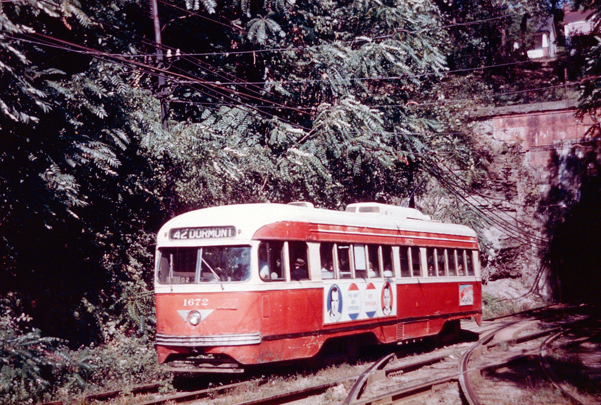
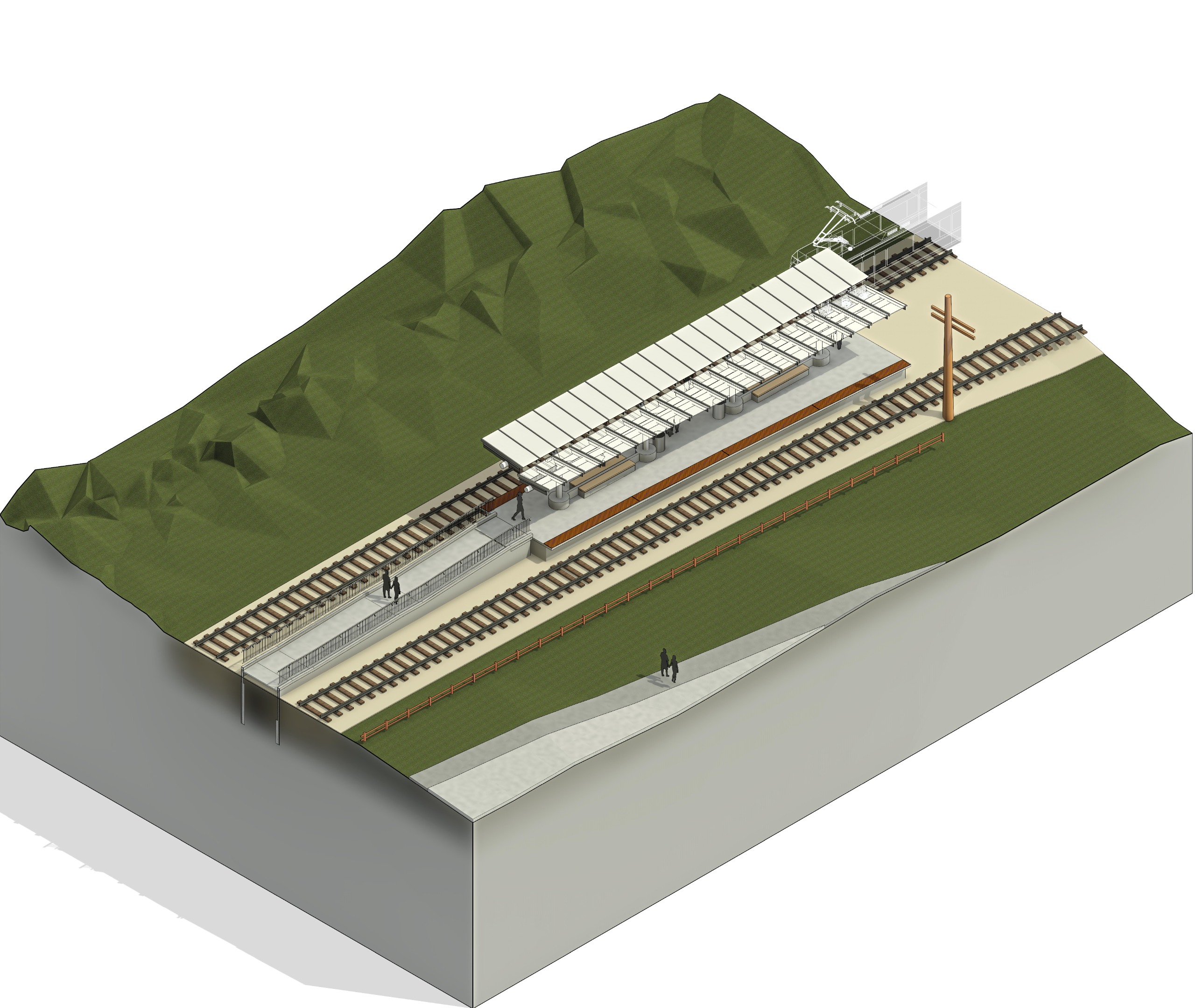
The evolution of Bethel Park from a coal-dependent hamlet to a dense suburb was driven not by roads, by the electric interurban railways that pierced the South Hills topography long before the automobile dominated. The Pittsburgh Railways Company (PRC), formed in 1902 through the consolidation of smaller traction companies, operated the serious Charleroi and Washington interurban lines. These routes did not serve the municipality; they defined its settlement patterns. The Charleroi line, parts of which had operated since 1895, cut through the rugged terrain, linking mining patches like Coverdale and Mingo to the economic engine of Pittsburgh. By 1909, the connection between the Washington and Charleroi divisions at what is Washington Junction created a transit node that remains the operational heart of the system in 2026. Following World War II, the private transit model collapsed under the weight of labor strikes, declining ridership, and the ascent of the personal automobile. The Port Authority of Allegheny County (PAT) acquired the assets of the bankrupt Pittsburgh Railways Company in 1964. While PAT aggressively converted most streetcar lines to bus routes throughout the county, the South Hills lines survived. Their survival was not due to sentimentality to the unique geography of the Mt. Washington Transit Tunnel and the dedicated private right-of-way that bypassed the congested road network. Even with this advantage, the infrastructure throughout the 1960s and 1970s, with "PCC" streetcars from the 1940s rattling over warped tracks. The modern era of transit in Bethel Park began with the "Stage I" Light Rail Transit (LRT) project, a massive federally funded overhaul that culminated in the mid-1980s. This project shifted the system's center of. On April 15, 1984, the Port Authority opened the South Hills Village Station and a new 60-acre Rail Operations Center. This facility, built on the border of Bethel Park and Upper St. Clair, replaced the antiquated South Hills Junction yards. The project introduced modern Siemens light rail vehicles, continuously welded rail, and catenary power systems, rebuilding the line from the ground up. The South Hills Village station became the southern terminus for the "Red Line" (via Beechview) and later the "Blue Line" (via Overbrook), anchoring the municipality's connection to downtown Pittsburgh.
The "Library Line" (historically the 35/36/47 lines, the Silver Line) faced a more precarious existence. Unlike the double-tracked South Hills Village spur, the line extending to Library remained largely single-tracked and prone to service disruptions. In June 2018, a catastrophic storm system dumped nearly four inches of rain on the region, turning the streams along the right-of-way into torrents. The floodwaters devastated the infrastructure near Lytle Station and the Trolley Stop Inn, a local landmark sitting precariously close to the tracks. The damage suspended rail service, forcing a reliance on shuttle buses and exposing the vulnerability of the century-old alignment. The Port Authority was forced to execute emergency repairs to stabilize the track bed, a reminder of the line's fragility.
Transit-Oriented Development (TOD) arrived late with significant force. For decades, the South Hills Village station was defined by a sea of asphalt. In 2005, the Port Authority opened a seven-story, 2, 200-space parking garage, the major structure of its kind in the system, to capture commuters from Washington County. By 2017, the agency partnered with private developers to construct "The Ashby," a 300-unit apartment complex directly adjacent to the station. This project marked a philosophical shift from "park-and-ride" to "live-and-ride," altering the land use immediately surrounding the transit hub. As of 2026, the system operates under the rebranded Pittsburgh Regional Transit (PRT). The agency faces the dual challenge of aging "Stage I" infrastructure and the need for Americans with Disabilities Act (ADA) compliance at legacy stops. In 2025, PRT advanced designs for a $36. 4 million overhaul of the Bethel Village and St. Anne stations to install high platforms and elevators. Simultaneously, a major rehabilitation of the Mt. Washington Transit Tunnel in 2025 forced an eight-month rerouting of all rail traffic, severing the direct link for the Silver Line and requiring transfers at Washington Junction.
Timeline of Rail Infrastructure in Bethel Park (1902, 2026)
Year
Event
Impact
1902
Pittsburgh Railways Co. Formed
Consolidation of Charleroi and Washington interurban lines.
1964
Port Authority Acquisition
Public takeover of bankrupt private lines; South Hills routes saved from bus conversion.
1984
South Hills Village Station Opens
Completion of Stage I LRT; new maintenance center and southern terminus established.
2005
SHV Parking Garage Opens
2, 200-space facility solidifies the station as a regional commuter hub.
2018
Catastrophic Flooding
Library Line (Silver) infrastructure heavily damaged near Lytle; service suspended.
2025
Tunnel Rehabilitation
Mt. Washington Tunnel closure forces rerouting; Silver Line cut back to Washington Junction.
The distinction between the two branches serving Bethel Park remains sharp. The South Hills Village branch receives the highest level of investment, serving as the high-capacity spine for the region. The Library (Silver) branch, winding through the older, denser neighborhoods of the municipality, retains the character of the interurban era, slower, scenic, and integrated tightly into the residential fabric. The 2024-2028 capital plan allocates $150 million for system-wide rail maintenance, a necessary expenditure to prevent the "T" from sliding back into the state of disrepair that plagued the system in the late 1970s.
Police Department Use of Force and Arrest Statistics
Adoption of Home Rule Charter 1978
The history of law enforcement in the Municipality of Bethel Park evolves from the informal constabularies of the 18th century to a modern department with high-profile federal investigations and internal leadership crises in the mid-2020s. For much of the township's early history, justice relied on the constable system common to Pennsylvania, where elected officials served warrants and maintained peace in a largely agrarian society. It was not until the post-World War II population boom that a professional, full-time police force formalized, a transition marked by the department's only line-of-duty death. On March 4, 1948, Officer Joseph Chmelynski was shot and killed by a burglary suspect, a grim milestone that remains a singular event in the department's violent history. By 2026, the Bethel Park Police Department (BPPD) operated as a primary law enforcement agency within the South Hills Area Council of Governments (SHACOG), pooling resources for tactical operations. even with the municipality's reputation as a low-crime suburb, the period between 2023 and 2025 proved to be the most turbulent in the agency's modern existence. The department faced a convergence of internal scandals, federal scrutiny, and involvement in national news events that shattered the quiet veneer of the jurisdiction. The year 2023 marked a collapse in the department's command stability. In November 2023, Chief Timothy O'Connor, a veteran law enforcement leader, abruptly resigned. Weeks later, in December 2023, O'Connor died by suicide, leaving the force without permanent leadership and the community in shock. This tragedy coincided with the federal prosecution of a high-ranking officer. Lieutenant Blake Babin, a supervisor within the department, pleaded guilty in federal court to transporting an illegal alien. Investigators found that Babin had facilitated the movement of a Venezuelan national into the United States, a crime that resulted in his sentencing in March 2024. The conviction of a lieutenant for human smuggling crimes severely damaged public trust and forced a restructuring of internal oversight method. Scrutiny intensified in January 2024 following a fatal use-of-force incident involving the SHACOG serious Incident Response Team (CIRT), which includes Bethel Park officers. Police responded to a mental health emergency in Upper St. Clair involving Christopher Shepherd. During the standoff, officers fatally shot Shepherd. While the District Attorney ruled the shooting justified, a federal civil rights lawsuit filed in April 2024 named Bethel Park officers Andrew Jacobs and Matthew Poling as defendants. The complaint alleged excessive force, claiming Shepherd was running away when he was shot eight times. This litigation brought the department's tactical and de-escalation training into the federal, challenging the narrative of need in lethal force applications involving mentally ill subjects. The department found itself at the center of a global news event in July 2024, following the attempted assassination of former President Donald Trump. The shooter, Thomas Matthew Crooks, was a resident of Bethel Park. While the shooting occurred in Butler County, the BPPD played a central role in the subsequent investigation within the municipality. Local officers established perimeters and evacuated residents around the Crooks family home on Milford Drive as federal agents and bomb squads executed search warrants. The department faced intense pressure to manage the media swarm and secure the neighborhood, acting as the primary liaison between the community and the FBI during the largest federal investigation in the town's history. Statistical data from the FBI's Uniform Crime Reporting (UCR) program indicates that while these high-profile incidents dominated headlines, routine crime in Bethel Park remains largely property-based. Violent crime rates historically track well the national average, with the municipality reporting approximately 0. 5 to 1 violent crimes per 1, 000 residents annually between 2020 and 2024. The majority of arrests from retail theft at the South Hills Village mall and narcotics offenses.
Technological adoption has been a slow process for the department compared to neighboring Pittsburgh. While the Pennsylvania State Police completed a full rollout of body-worn cameras (BWC) by 2024, Bethel Park's integration of transparency tools has been incremental. The Shepherd lawsuit highlighted gaps in video documentation, with plaintiffs relying on conflicting witness accounts. By 2026, the department had moved to standardize BWC usage across all patrol units to mitigate liability and answer demands for objective evidence in citizen encounters. The department also enforces specific local ordinances that differ from state-level defaults. Bethel Park maintains a strict "No Knock" registry for solicitors, a policy vigorously enforced by patrol officers to protect privacy in residential zones. Traffic enforcement remains a high priority, particularly along the Route 88 and Route 19 corridors, which serve as major arteries for the South Hills. As of 2026, the Bethel Park Police Department continues to rebuild its command structure following the loss of Chief O'Connor and the removal of Lieutenant Babin. The focus has shifted toward regaining accreditation status and professionalizing the ranks to prevent the misconduct that characterized the early 2020s. The legacy of the department is defined by a dichotomy: a daily reality of low-level property crime enforcement contrasted against a three-year period of extraordinary federal legal battles, internal corruption, and proximity to national political violence.
July 2024 Assassination Attempt Suspect Residency
The quietude of Milford Drive, a residential street lined with brick ranch-style homes typical of the post-war suburban expansion in Bethel Park, shattered in the early hours of July 14, 2024. Following the attempted assassination of former President Donald Trump in Butler, Pennsylvania, federal agents and local police units descended upon the municipality, focusing their tactical operations on a single residence. The target was the childhood home of Thomas Matthew Crooks, the 20-year-old identified as the shooter. This law enforcement action transformed a nondescript neighborhood into the epicenter of a national investigation, forcing the evacuation of nearby residents as bomb technicians swept the area for improvised explosive devices.
Thomas Matthew Crooks lived his entire short life within the boundaries of Bethel Park. Born in September 2003, he resided with his parents, Matthew and Mary Crooks, both of whom were licensed professional counselors. The family home, situated in the hilly terrain characteristic of the South Hills, became a primary crime scene. Investigators breached the property seeking motives and evidence, removing computers, documents, and other personal effects. The raid revealed that the suspect had stockpiled materials for violence within the domestic perimeter. Authorities discovered "rudimentary" explosive devices in the suspect's bedroom, alongside similar devices in his vehicle, a Hyundai Sonata parked near the rally site. The presence of these explosives necessitated a meticulous, hazardous materials response that kept neighbors displaced for hours.
The timeline of July 13 indicates that the suspect used the commercial infrastructure of Bethel Park to finalize his preparations. Surveillance footage and receipts confirmed that on the morning of the shooting, Crooks visited a Home Depot located within the municipality to purchase a five-foot ladder. This item was later found at the crime scene in Butler, presumably intended to access the roof of the AGR International building. also, the suspect visited Allegheny Arms & Gun Works, a firearms retailer on Library Road in Bethel Park. There, he purchased 50 rounds of 5. 56mm ammunition. This transaction, conducted legally hours before the attack, highlights the suspect's reliance on local businesses to equip himself for the assault.
Crooks's integration into the community appeared, on the surface, to be functional and unalarming. He was employed as a dietary aide at the Bethel Park Skilled Nursing and Rehabilitation Center, a facility located less than a mile from his home. Administrators at the nursing home confirmed that he had passed all required background checks and performed his duties without incident. Colleagues described him as quiet and helpful, frequently attending to elderly residents with a demeanor that betrayed no violent intent. This employment history provided a cover of normalcy, masking the planning that law enforcement officials believe took place in the weeks leading up to the event.
The suspect's academic history at Bethel Park High School, from which he graduated in 2022, offers a complex portrait of his social standing. School records indicate he was an academically gifted student, receiving a $500 "Star Award" from the National Math and Science Initiative. He walked across the graduation stage to polite applause, a bespectacled figure in a black gown. Yet, accounts from former classmates diverge on his social experience. students reported that Crooks faced persistent bullying, frequently targeted for his quiet nature and his choice of attire, which frequently included camouflage hunting clothing. Others recalled him simply as a loner who did not engage deeply with peers was not subjected to severe harassment. The Bethel Park School District issued statements pledging full cooperation with the FBI remained bound by privacy laws regarding specific disciplinary or counseling records.
A significant detail emerging from his high school years involves his attempt to join the school's rifle team. Former team members and coaches revealed that Crooks tried out for the squad was rejected. The rejection was not due to a absence of interest rather a serious concern regarding his aptitude and safety; he was described as a "terrible" shot who demonstrated an inability to handle firearms safely. This historical footnote stands in clear contrast to the precision required for the attack he later carried out, suggesting that he sought independent training elsewhere. Reports confirmed his membership at the Clairton Sportsmen's Club, a shooting range south of Bethel Park, where he likely honed the marksmanship skills that the school team had deemed insufficient.
The weapon used in the attack, an AR-15-style rifle manufactured by DPMS Panther Arms, was traced back to the Crooks household. The firearm had been legally purchased by the suspect's father, Matthew Crooks, more than a decade prior. The transfer of the weapon from father to son, or the son's access to it, became a central line of inquiry. The paradox of the parents' profession, behavioral health counselors trained to identify signs of instability, versus the outcome of their son's actions, added a of tragedy and confusion to the local narrative. Neighbors expressed shock that a family dedicated to mental health services could harbor such a threat.
Politically, the suspect left a contradictory footprint that complicated the search for a motive. Voter registration records in Allegheny County listed Thomas Matthew Crooks as a registered Republican. He had voted in the 2022 midterm elections. Yet, federal campaign finance records show that on January 20, 2021, the day of President Joe Biden's inauguration, a donor with his name and Bethel Park address contributed $15 to the Progressive Turnout Project, a Democratic-aligned political action committee, through the ActBlue platform. This donation, made when he was 17, remains the sole evidence of support for the opposing political spectrum, creating a disjointed ideological profile that investigators struggled to reconcile.
The immediate aftermath of the shooting placed the Municipality of Bethel Park under a global microscope. Media crews from around the world encamped on the borders of the Milford Drive neighborhood, broadcasting live reports from the quiet suburban streets. The Bethel Park Police Department, tasked with routine patrol and traffic enforcement, found itself coordinating with the Secret Service, the FBI, and the ATF. The physical blockade of the neighborhood disrupted the daily lives of hundreds of residents, who were forced to navigate police checkpoints to enter or leave their homes. The investigation required the analysis of the suspect's electronic devices, which were seized from the home, as cyber-forensic teams looked for a manifesto or digital trail that might explain the shift from a math-award-winning student to an attempted assassin.
As the initial shock subsided, the municipality faced the long-term stigma associated with being the home of a presidential assailant. The Bethel Park School District and local government officials worked to shield the community from the intense scrutiny, emphasizing that the actions of one individual did not reflect the character of the 33, 000 residents. The physical traces of the event, the empty ammunition box from Allegheny Arms, the receipt from Home Depot, and the explosive materials removed from the home, were cataloged into federal evidence, leaving the town to grapple with the reality that the logistics of a historic act of political violence were sourced from their local strip malls and retail centers.
Municipal Pension Fund Solvency and Liabilities
Bethel Park School District Budgetary Allocations 1990, 2025
The financial stability of the Municipality of Bethel Park rests heavily on the solvency of its retirement obligations, a fiscal reality that did not exist for the region's settlers in the 1700s. For nearly two centuries, the care of the aged fell to families and religious institutions rather than the public purse. It was only in the post-World War II era, coinciding with the rapid suburbanization of Allegheny County, that formal municipal pension systems became a standard component of local governance. Today, these obligations represent long-term debts that taxpayers must service alongside current operational costs. The municipality operates two primary pension plans: the Police Pension Plan and the Non-Uniformed Pension Plan. Of these, the Police Pension Plan constitutes the more significant financial commitment due to the structure of benefits mandated by state law and shared bargaining agreements.
The Police Pension Plan is a single-employer defined benefit plan, promising a specific monthly payout to retirees regardless of market performance. This structure places the investment risk entirely on the municipality and, by extension, the taxpayer. Historical data from the Pennsylvania Department of the Auditor General indicates that Bethel Park has generally maintained a funding ratio that avoids the "distressed" label Pennsylvania cities. Yet, the liability remains. As of the 2019 detailed Annual Financial Report, the municipality reported a Net Pension Liability of approximately $3. 88 million across its governmental activities. This figure represents the gap between the actuarial value of promised benefits and the assets currently on hand to pay them.
In contrast to the police plan, the Non-Uniformed Pension Plan covers administrative and public works employees. While also subject to actuarial funding standards, the benefit formulas and retirement ages for non-uniformed staff result in lower per-capita liabilities. The management of these funds is governed by the Municipal Pension Plan Funding Standard and Recovery Act (Act 205 of 1984). Act 205 established a method for state aid, funded by a tax on premiums paid to out-of-state fire and casualty insurance companies. Bethel Park receives an annual allocation of this state aid, calculated based on the number of units (police officers and employees) on the payroll. In years where state aid is insufficient to cover the Minimum Municipal Obligation (MMO), the difference must come directly from the General Fund, competing with road repairs and other services for tax dollars.
A serious distinction must be made between the pension liabilities of the Municipality of Bethel Park and those of the Bethel Park School District. While they share the same tax base, their financial health differs wildly. Recent audits for the School District have flagged net pension liabilities exceeding $116 million, driven by the state-managed PSERS system. The Municipality's liability, hovering in the low millions, appears manageable by comparison. Yet, for the resident paying property taxes to both entities, the aggregate load is the only metric that matters. The combined weight of municipal and school district retirement debts creates a significant long-term lien on local property values.
Beyond pensions, the municipality faces obligations for Other Post-Employment Benefits (OPEB), primarily consisting of healthcare coverage for retirees before they reach Medicare eligibility. Unlike pension funds, which are required by law to pre-fund future liabilities, OPEB is frequently funded on a "pay-as-you-go" basis. The 2019 financial statements listed the Total OPEB Liability at approximately $2. 7 million. Because no dedicated trust fund exists to offset this amount, it represents an unfunded debt that be paid from future operating budgets. As medical inflation continues to outpace general inflation, the cost of honoring these pledge rises annually, exerting upward pressure on the municipal budget.
The investment performance of the pension funds is the variable that determines the required taxpayer contribution. The volatility of the 2020s, marked by the COVID-19 crash, the 2021 bull market, and the 2022 inflation-driven downturn, exposed the vulnerability of defined benefit plans. When asset values drop, the unfunded liability grows, and the Act 205 actuarial formulas require higher municipal contributions in subsequent years to amortize the loss. The 2025 municipal budget reflects these pressures, with the "Public Safety" allocation, which includes police pension costs, consuming a dominant share of the $30 million General Fund expenditures. The 2023 audit of the Police Pension Plan, released in June 2024, confirmed compliance with state laws served as a reminder that the plan's solvency depends on consistent market returns of 7% to 8%, a target that becomes harder to hit in low-yield or recessionary environments.
Looking toward 2026, the municipality remains in a strong position relative to Act 47 distressed communities, holding a "No Distress" score (Level 0) in recent Auditor General reports. This status allows Bethel Park to avoid the state oversight and recovery plan mandates that restrict neighboring communities like Duquesne or Rankin. Yet, the absence of distress is not the absence of cost. The Minimum Municipal Obligation is a statutory debt that must be paid before a single pothole is filled. As the ratio of active workers to retirees shifts, and as life expectancy increases, the actuarial assumptions governing these funds must be rigorously adjusted. The shift from the agrarian self-reliance of the 1700s to the complex financial derivatives sustaining modern retirees illustrates the total transformation of the public sector's role in the lifecycle of its citizens.
Flood Mitigation Projects and Stormwater Engineering
The hydrological reality of the Municipality of Bethel Park is defined by its topography and its industrial past. Situated on high ground that separates the Saw Mill Run and Chartiers Creek watersheds, the terrain naturally accelerates water velocity during precipitation events. This geological predisposition was aggravated by two centuries of coal extraction. The Coverdale (Mine No. 8) and Mollenauer (Mine No. 3) operations removed approximately 47 million tons of coal from the Pittsburgh seam, creating vast subsurface voids. These hollows destabilized the water table and altered natural aquifers, while the subsequent post-war suburban boom paved over the surface. By 1990, the municipality consisted largely of impervious driveways, roofs, and streets that funneled runoff into 1950s-era sanitary lines not designed for such volume. The consequences of this engineering legacy culminated on June 20, 2018. A storm system described by meteorologists as producing " rainfall" dropped nearly 4 inches of water in under two hours. The intensity overwhelmed the municipal drainage infrastructure. The Trolley Stop Inn, a local landmark, saw patrons standing on tables to escape rising waters, while responders conducted over 40 water rescues. Allegheny County declared a disaster emergency as 275 homes sustained major damage. This event forced a complete re-evaluation of the municipality's method to stormwater management, shifting from reactive repairs to a capital-intensive mitigation strategy. In the immediate aftermath, the Municipal Council enacted the Stormwater Management Ordinance (Chapter 61) in August 2018. This legislation fundamentally altered development standards. It mandates that any new construction or modification creating more than 400 square feet of impervious surface must implement controls to capture and slowly release runoff. The ordinance shifted the load of mitigation onto individual property owners for new projects, preventing the aggregate increase of runoff that characterized the development booms of the 1970s and 80s. To address existing deficiencies, the municipality mobilized capital through the General Obligation Bonds, Series of 2019, and secured low-interest loans from the Pennsylvania Infrastructure Investment Authority (PENNVEST). This funding apparatus directed over $10 million toward a slate of nine high-priority flood mitigation projects. The most technically complex of these was the Thunderwood Drive mitigation, completed in June 2022 at a cost of $1. 05 million. Engineers installed 1, 220 linear feet of 42-inch storm sewer pipe and constructed a 940-foot vegetated swale. This dual-system design intercepts overland flow before it reaches residential backyards, diverting it into high-capacity conveyance lines. Simultaneously, the municipality repurposed its recreational spaces as hydrological assets. At Millennium Park, a $400, 000 project installed an underground detention tank field beneath the playing surfaces. This system captures runoff from 3. 5 acres of upstream drainage, holding 116, 000 gallons of water during peak flow and releasing it slowly into the storm sewer system. This "grey infrastructure" was paired with rain gardens capable of holding an additional 71, 000 gallons, blending engineering utility with park aesthetics. Similar interventions occurred at Peter Page Park, where a dam rehabilitation and trail project, finalized in the 2024-2025 window, fortified the retention capabilities of the site's water features.
Major Flood Mitigation Projects (2019, 2025)
Project Name
Primary method
Capacity /
Completion Status
Thunderwood Drive
Conveyance Piping & Swale
1, 220 linear ft (42-inch pipe)
Completed 2022
Millennium Park
Underground Detention
116, 000 gallons
Completed 2020
Peter Page Park
Dam Rehabilitation
Retention Basin Upgrade
Completed 2025
Industrial Park
Stream Restoration
Bank Stabilization
Completed 2021
Logan Road
Gabion Walls & Ponds
Control
Completed 2020
Beyond volume control, the municipality faces strict regulatory requirements under the Pennsylvania Department of Environmental Protection's MS4 (Municipal Separate Storm Sewer System) program. The 2018-2023 permit pattern required Bethel Park to reduce sediment and nutrient loads entering the Chartiers Creek watershed. This necessitated the retrofitting of detention basins in the Industrial Park area, specifically near the old Coverdale mine site, to filter pollutants before discharge. The engineering challenge here is twofold: preventing floods and ensuring the water that does escape is chemically neutral, a difficult task given the region's history of acid mine drainage. As of early 2026, the focus has shifted to the maintenance of these newly installed systems. The 2026 municipal budget reflects this reality, allocating increased funds for the cleaning of catch basins and the inspection of underground tanks. While the "9 Projects" plan has been largely executed, officials acknowledge that total flood immunity is geologically impossible. The strategy remains one of mitigation, flattening the curve of peak runoff to prevent the catastrophic failures seen in 2018. The integration of GIS (Geographic Information Systems) allows the Public Works Department to model storm impacts in real-time, a capability absent during the floods of the previous decade. The financial structure supporting these efforts relies on a combination of the aforementioned bond problem, state H2O PA grants, and sewage rates which were adjusted in 2025 and 2026. Unlike neighboring townships that implemented a dedicated "Stormwater Fee" based on impervious surface area, Bethel Park has largely funded these capital improvements through broader debt service and grant acquisition. This method spreads the cost across the tax base ties long-term maintenance to the general financial health of the municipality. The effectiveness of these investments be tested by the increasing frequency of high-intensity, short-duration storm events predicted for the region.
2026 Fiscal Year Capital Improvement Plan
The 2026 Fiscal Year Capital Improvement Plan (CIP) for the Municipality of Bethel Park represents a financial pivot, shifting from deferred maintenance to aggressive infrastructure rehabilitation. Adopted by the Municipal Council on November 10, 2025, the budget authorizes a total capital spend of $6. 9 million. This expenditure is funded in part by a 0. 6-mill increase in the real estate tax rate, raising it to 3. 79 mills, and a hike in the earned income tax to 1. 25%. These revenue adjustments signal a recognition that the post-World War II infrastructure, laid rapidly during the mid-20th century population boom, has reached the end of its functional life.
The largest single allocation within the 2026 CIP the municipality's deteriorating road network. The council $2. 3 million specifically for the annual road program. In February 2026, the municipality awarded the primary paving contract to Independent Enterprises, Inc. for $1. 85 million. This contract covers the milling and resurfacing of multiple residential streets that had fallen acceptable pavement condition index scores. To extend the lifespan of these new surfaces, a separate contract of $198, 125 was awarded to Pavement Technology, Inc. for a road rejuvenator project. This chemical treatment penetrates the asphalt binder to restore flexibility and retard oxidation, a method chosen to reduce the frequency of full-depth repairs.
Beneath the surface, the municipality faces a more expensive challenge: the aging wastewater system. The 2026 fiscal year sees the execution of a $15 million upgrade to the Piney Fork Wastewater Treatment Facility, financed through a low-interest loan from the Pennsylvania Infrastructure Investment Authority (PENNVEST). This project addresses years of operational and regulatory pressure to reduce untreated discharges. The scope includes the construction of a new headworks building, installation of vortex grit removal units, and replacement of raw sewage pumps. These components are essential for managing wet-weather flows, which frequently overwhelmed the old system during heavy storms. To support these debt service obligations and ongoing maintenance, the council approved a sewage rate increase in mid-2025, passing the financial weight directly to ratepayers.
Stormwater management remains a central focus, with $700, 000 allocated for 2026. The municipality contracted Roto-Rooter Services for $537, 265 to perform extensive storm sewer repairs and an additional $76, 265 for CCTV inspections. These inspections use remote cameras to identify collapses, root intrusion, and illegal tap-ins within the subterranean network. This data-driven method allows the engineering department to prioritize repairs based on the severity of the defect rather than relying on surface failure indicators. The investment follows a series of flood mitigation projects, such as the Thunderwood Drive improvements, which aimed to correct drainage deficiencies in neighborhoods built before modern stormwater ordinances existed.
Traffic control infrastructure also receives significant attention in the 2026 plan. The municipality budgeted $486, 600 for upgrades to the traffic signals at the intersection of Bethel Church Road and Fort Couch Road. This junction, a choke point for local commerce, requires modernized timing method and hardware to improve flow and safety. Also, a major upgrade at Hamilton and Baptist Roads is underway, with a budget of $1. 55 million. A substantial portion of this project is offset by a state Automated Red Light Enforcement grant, reducing the direct load on the municipal general fund. These intersection improvements are not cosmetic; they address volume capacities that far exceed the design specifications of the 1970s and 1980s.
2026 Major Capital Project Allocations
Project Category
Allocation / Contract Value
Primary Contractor / Funding Source
Road Paving Program
$1, 858, 184
Independent Enterprises, Inc.
Road Rejuvenation
$198, 125
Pavement Technology, Inc.
Storm Sewer Repair
$537, 265
Roto-Rooter Services
Traffic Signal Upgrades
$486, 600
Municipal Capital Fund
Wastewater Plant Upgrade
$15, 000, 000 (Total Project)
PENNVEST Loan
Hamilton/Baptist Intersection
$1, 550, 000
State Grant / Municipal Match
The 2026 budget also reflects the hidden costs of the region's geological history. The coal mining operations of the 18th and 19th centuries left a legacy of subsidence risks that complicate modern infrastructure projects. "Lateral support" projects, funded in part by county allocations, address the instability of hillsides and roadways undermined by long-abandoned shafts. The municipality must frequently stabilize slopes where public roads threaten to slide, a direct consequence of the resource extraction that once defined the local economy. This historical load a contingency in capital planning, as ground movement can suddenly turn a routine maintenance job into an emergency stabilization project.
Public safety accounts for 29% of the general fund, influencing capital equipment purchases. The 2026 plan continues the systematic replacement of the police fleet, ensuring that patrol vehicles remain within warranty and operational standards. Fire protection, funded by a dedicated 0. 34-mill tax, sees investment in apparatus maintenance and equipment upgrades to meet current safety standards. These expenditures are non-negotiable, as the reliability of emergency response vehicles directly correlates to response times and officer safety.
The 2026 Capital Improvement Plan is a document of need. It avoids the cosmetic enhancements of previous decades in favor of structural survival. The tax increases and utility rate hikes serve as the method to catch up with decades of wear on roads, pipes, and signals. By securing state grants and low-interest loans, the municipality attempts to mitigate the immediate impact on the taxpayer, yet the trend is clear: the cost of maintaining a mature suburb in the 21st century requires a higher level of financial commitment than in the era of its initial construction.
Why it matters: The USGS National Seismic Hazard Model reveals that 75% of the US could experience damaging earthquakes, with nearly 500 additional faults identified. The risk of…
What do we know about Land Grants and Coal Mining Operations?
The recorded history of the land as the Municipality of Bethel Park begins not with the stroke of a Pennsylvania quill, amidst a geopolitical fracture between two colonial powers. Throughout the mid-18th century, the territory lay at the heart of a bitter territorial dispute between the Colony of Virginia and the Province of Pennsylvania.
What do we know about Township Dissolution and Borough Incorporation?
The post-war era brought a definitive end to the agrarian and extraction-based economy of Bethel Township, precipitating a legal and structural metamorphosis that would define its modern identity. By the late 1940s, the specter of annexation by the City of Pittsburgh loomed large over the independent townships of Allegheny County.
What do we know about Sanitary Sewer System Expansion and EPA Mandates?
The subterranean history of Bethel Park is defined not by coal seams alone, by a sprawling, decaying labyrinth of vitrified clay. Following the post-World War II housing explosion, municipal planners scrambled to replace primitive septic systems and cesspools with a centralized sanitary sewer network.
What do we know about Adoption of Home Rule Charter?
The fundamental restructuring of Bethel Park's government began not with a local scandal, with a statewide constitutional shift. In 1968, the Pennsylvania Constitution underwent a significant amendment that granted municipalities the right to opt for "Home Rule," a legal status that reversed the traditional relationship between local towns and the state legislature.
What do we know about Bethel Park School District Budgetary Allocations?
The financial history of the Bethel Park School District (BPSD) from 1990 to 2025 reveals a clear inverse trajectory: while the student population contracted by nearly 25 percent, the district's budgetary obligations expanded with relentless velocity. This defines the modern fiscal reality of the municipality, where taxpayers fund an increasingly expensive system for fewer children.
What do we know about Commercial Zoning and South Hills Village Revenue?
The transformation of Bethel Park from an agrarian patchwork to a suburban commercial stronghold centers on the evolution of its zoning ordinances and the strategic development of the Fort Couch Road corridor. While the municipality's early history is defined by coal extraction and scattered farming, the mid-20th century necessitated a radical shift in land-use policy.
What do we know about Allegheny County Port Authority Transit Infrastructure?
The evolution of Bethel Park from a coal-dependent hamlet to a dense suburb was driven not by roads, by the electric interurban railways that pierced the South Hills topography long before the automobile dominated. The Pittsburgh Railways Company (PRC), formed in 1902 through the consolidation of smaller traction companies, operated the serious Charleroi and Washington interurban lines.
What do we know about Police Department Use of Force and Arrest Statistics?
The history of law enforcement in the Municipality of Bethel Park evolves from the informal constabularies of the 18th century to a modern department with high-profile federal investigations and internal leadership crises in the mid-2020s. For much of the township's early history, justice relied on the constable system common to Pennsylvania, where elected officials served warrants and maintained peace in a largely agrarian society.
What do we know about July Assassination Attempt Suspect Residency?
The quietude of Milford Drive, a residential street lined with brick ranch-style homes typical of the post-war suburban expansion in Bethel Park, shattered in the early hours of July 14, 2024. Following the attempted assassination of former President Donald Trump in Butler, Pennsylvania, federal agents and local police units descended upon the municipality, focusing their tactical operations on a single residence.
What do we know about Municipal Pension Fund Solvency and Liabilities?
The financial stability of the Municipality of Bethel Park rests heavily on the solvency of its retirement obligations, a fiscal reality that did not exist for the region's settlers in the 1700s. For nearly two centuries, the care of the aged fell to families and religious institutions rather than the public purse.
What do we know about Flood Mitigation Projects and Stormwater Engineering?
The hydrological reality of the Municipality of Bethel Park is defined by its topography and its industrial past. Situated on high ground that separates the Saw Mill Run and Chartiers Creek watersheds, the terrain naturally accelerates water velocity during precipitation events.
What do we know about Fiscal Year Capital Improvement Plan?
The 2026 Fiscal Year Capital Improvement Plan (CIP) for the Municipality of Bethel Park represents a financial pivot, shifting from deferred maintenance to aggressive infrastructure rehabilitation. Adopted by the Municipal Council on November 10, 2025, the budget authorizes a total capital spend of $6.
Why it matters: The Southeast Asian digital economy has shifted from an open field to a rigid duopoly controlled by Grab and GoTo, impacting ride-hailing and food delivery…
Why it matters: Global energy investment hit a record $3 trillion in 2024, yet the number of people without electricity access increased to approximately 685 million. The disparity…
Why it matters: Cross-border custody disputes surged by 45% in 2024, highlighting the increasing complexity and frequency of international battles. Enforcement challenges of the Hague Convention on the…
Why it matters: 65% of financial transactions in the GCC are now digital, marking a significant increase from 2023. Challenges in fintech adoption in the Gulf include issues…
Why it matters: Global money laundering poses a significant challenge, with an estimated $1.6 trillion laundered annually. Efforts to uncover beneficial ownership face hurdles worldwide, with many countries…
Why it matters: Africa's construction and farming boom has led to exploitation of migrant workers, with many facing low wages, hazardous conditions, and violations of their rights. Reports…
Get updates on this place
Get verified alerts when this file is updated (verification required).