Verified Against Public And Audited RecordsLast Updated On: 2026-02-27
Reading time: ~57 min
File ID: EHGN-PLACE-33427
Investigative Bio of Municipality of Monroeville
Agrarian Origins and the Patton Township Era (1750, 1951)
The Municipality of Monroeville, a commercial and residential powerhouse in Allegheny County, did not begin as a unified suburban entity. Its origins lie in the agrarian soil of the 18th century, defined by subsistence farming, Scots-Irish determination, and the logistical demands of crossing the Appalachian frontier. For two centuries, the land known as Monroeville existed as **Patton Township**, a rural jurisdiction whose identity was forged by the plow, the coal pick, and the turnpike. The recorded history of the area predates the American Revolution. In the mid-18th century, the region was a dense wilderness traversed by trading route. The documented European presence involved the "Widow's Dower" tract, settled by the Myers family near Turtle Creek in the 1760s. yet, the **Johnston family** is widely recognized as the area's permanent settlers. In 1789, Captain Robert Johnston, a Revolutionary War veteran who served as a wagon master, secured a land grant for a tract he had surveyed years earlier. The Johnstons, along with the **Beatty, Clugston, and McCully families**, established a Scots-Irish farming community characterized by self-sufficiency. These early inhabitants cleared forests to plant crops and raise livestock, their lives dictated by the rhythms of the harvest and the isolation of the frontier. The political structure of the region formalized in the mid-19th century. Originally part of Plum Township, the southern portion grew distinct enough in population and need to warrant separation. In **1849**, the Court of Quarter Sessions of Allegheny County approved the division, creating **Patton Township**. The new municipality was named in honor of **Judge Benjamin Patton**, a sitting judge on the Allegheny County Court of Common Pleas (1844, 1849). At its inception, Patton Township was a sprawling rural expanse that included not only modern-day Monroeville also parts of what would later become the boroughs of Pitcairn, Wall, and Wilmerding. The township's namesake village, Monroeville, emerged from the intersection of commerce and agriculture. **Joel Monroe**, a farmer and real estate entrepreneur, purchased a 125-acre farm in 1829 that stretched from the Old Stone Church to the present-day municipal building. Monroe recognized the strategic value of the **Northern Turnpike** (later the William Penn Highway), a toll road completed in 1819 that connected Philadelphia to Pittsburgh. He began selling small lots along this artery, encouraging the growth of a village. In **1851**, the federal government approved a petition for a post office, and Monroe became the postmaster. The village was named "Monroeville" in his honor, though it remained a postal designation within the larger Patton Township for another century. While agriculture remained the dominant economic engine, the late 19th century introduced heavy industry to the township's periphery. The **Oak Hill Mine No. 4** opened in 1891, marking the beginning of significant coal extraction in the area. The **New York and Cleveland Gas and Coal Company** acquired vast tracts of land, employing miners to work the Pittsburgh coal seam that ran beneath the farms. Simultaneously, the **Pennsylvania Railroad** established the massive **Pitcairn Yard** in the 1880s along the township's southern border in the Turtle Creek Valley. This rail yard, one of the largest in the world, provided steady employment for Patton Township residents, creating a demographic of worker-farmers who toiled in the yards by day and tended their plots by evening.
Patton Township Population Growth (1860, 1880)
Year
Population
Notes
1860
957
census after separation from Plum Township.
1870
1, 193
Post-Civil War growth.
1880
1, 730
Expansion due to railroad and mining activity.
The 20th century brought the automobile, which fundamentally altered Patton Township's trajectory. The **William Penn Highway** (U. S. Route 22) was paved in **1924**, celebrated at the time as the "best paved road in Pittsburgh." This infrastructure upgrade transformed the township from an farming community into an accessible destination. Roadside commerce flourished; gas stations, diners, and produce stands sprang up to service travelers. The **Burke Glen Amusement Park**, opened in 1926 along the highway, became a regional attraction, signaling the area's shift toward a service-oriented economy. Even with these, Patton Township remained largely rural through the 1930s and 1940s. The was a patchwork of dairy farms, coal tipples, and scattered homes. yet, the end of World War II precipitated a massive suburban boom. The widening of Route 22 in **1942** to accommodate wartime traffic laid the groundwork for post-war development. Returning veterans and the explosion of automobile ownership created an insatiable demand for housing outside the smog-choked industrial valleys of Pittsburgh. By 1950, the pressure to modernize the municipal government became undeniable. The pastoral governance of a township was ill-equipped to handle the rapid subdivision of farms into housing plans like **Garden City**. also, the threat of annexation by neighboring boroughs seeking to expand their tax bases loomed over the growing community. To preserve its boundaries and manage its own zoning and services, the residents of Patton Township moved to incorporate. On **January 25, 1951**, Patton Township was officially re- as the **Borough of Monroeville**, ending 102 years of agrarian governance and inaugurating a new era of suburban dominance.
Municipal Incorporation and Home Rule Charter Governance
Agrarian Origins and the Patton Township Era (1750, 1951)
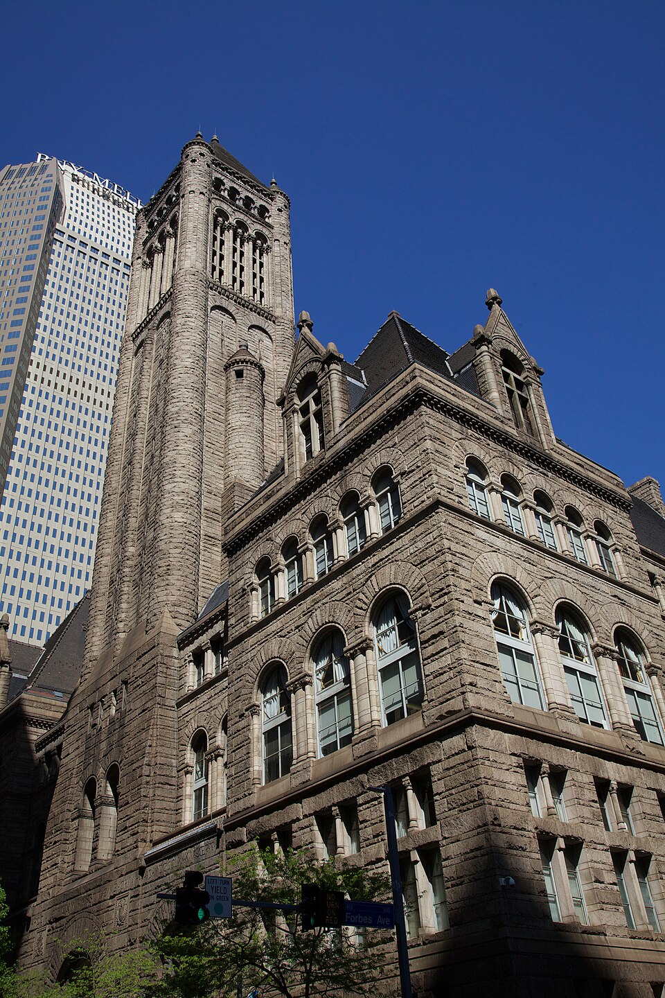
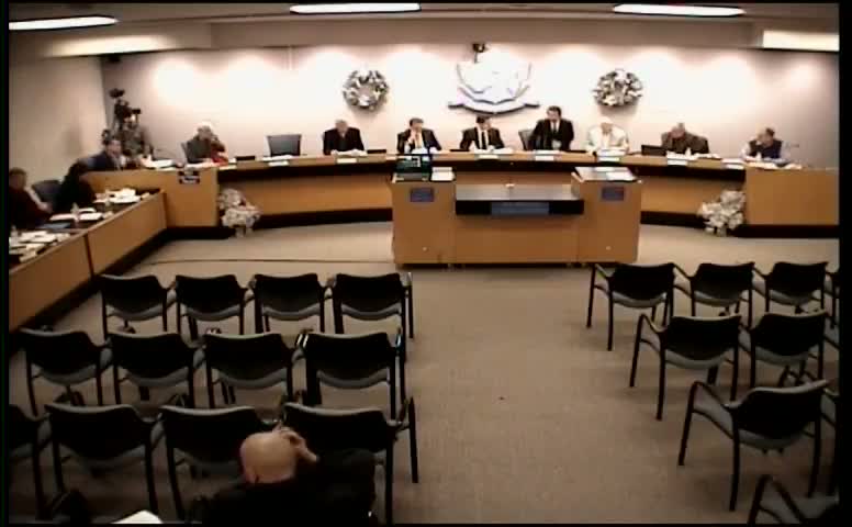
The transition from the agrarian Patton Township to the legal entity known as the Municipality of Monroeville was not an organic evolution a defensive maneuver. By the mid-20th century, the expanding City of Pittsburgh and the neighboring Borough of Wilkinsburg cast long shadows over the region. Annexation was a genuine threat; Pittsburgh had aggressively absorbed surrounding territories to expand its tax base. To preserve local autonomy and prevent the absorption of its burgeoning commercial corridors into the city's jurisdiction, the residents of Patton Township voted to incorporate. On January 25, 1951, the Court of Quarter Sessions of Allegheny County officially granted the charter, and Patton Township ceased to exist, replaced by the Borough of Monroeville. The name selected for the new borough paid homage to Joel Monroe, a 19th-century farmer and the area's postmaster. Monroe, who had operated the post office from his home along the Northern Turnpike ( William Penn Highway) starting in 1851, provided a distinct identity for the village that clustered around his property. While the name had been in informal use for the village center for a century, its elevation to the official municipal title in 1951 signaled a permanent break from the "Patton" identity, which was associated with the rural, coal-mining past. The new borough immediately faced the challenges of rapid suburbanization, as the opening of the Pennsylvania Turnpike's Pittsburgh Interchange in 1951 flooded the area with traffic, commerce, and new residents. For two decades, Monroeville operated under the Pennsylvania Borough Code. This state-level framework provided a rigid structure for governance, limiting the local government's ability to adapt to its explosive growth. By the early 1970s, the population had swelled, and the commercial district along Route 22, the "Miracle Mile", had become the economic engine of the eastern suburbs. The Borough Code's constraints on taxation, personnel management, and administrative flexibility proved insufficient for a jurisdiction of Monroeville's size and complexity. In response, a government study commission was formed to evaluate alternatives. On May 21, 1974, voters approved a Home Rule Charter, a decisive legal pivot that transferred significant powers from the state legislature to the local council. The Home Rule Charter, which became in January 1976, fundamentally altered the municipality's DNA. It officially changed the name from the "Borough of Monroeville" to the "Municipality of Monroeville," a distinction that carries legal weight regarding self-governance. The charter established a Council-Manager form of government, designed to professionalize operations. Under this system, the seven-member Council acts as the legislative body, setting policy and passing ordinances, while a professional Municipal Manager, appointed by Council, serves as the chief executive officer responsible for day-to-day administration. This separation of powers was intended to insulate the technical aspects of running the municipality, engineering, finance, and public safety, from the volatility of ward politics. Political representation in Monroeville is geographically distributed through a ward system. The municipality is divided into seven wards, each electing one council member to a four-year term. Terms are staggered to ensure continuity, with odd and even-numbered wards holding elections in alternating pattern. The Mayor, elected at-large, holds a position that is largely ceremonial under the Home Rule Charter compared to the "strong mayor" systems found in cities like Pittsburgh. The Mayor presides over Council meetings and retains the power to break tie votes, possesses no veto power and no direct administrative authority over municipal departments. This structure places immense responsibility on the Municipal Manager. The office of the Municipal Manager has been defined by long eras of stability punctuated by brief periods of turbulence. Marshall Bond, a figure synonymous with Monroeville's modern administration, served two distinct tenures totaling over 25 years. His term ran from 1973 to 1986, and he returned in 1998, serving until his retirement in 2010. Bond's administration is credited with professionalizing the municipal workforce and navigating the shift from a retail-heavy tax base to a more diversified economy. Following Bond, Timothy Little assumed the role in 2010. Little's tenure saw a brief interruption in 2012 due to political friction, leading to the short-lived appointment of Lynette McKinney. Council fired McKinney in 2014 and reinstated Little, who then provided a decade of steady leadership until his retirement in December 2023. In January 2024, Council appointed Alexander J. Graziani as the new Municipal Manager. Graziani, an experienced planner and former manager of Churchill Borough and the City of Latrobe, entered office during a serious fiscal realignment. His contract was renewed in January 2026 for a two-year term, signaling Council's confidence in his strategic direction. Graziani's administration immediately confronted the need of infrastructure reinvestment. In August 2025, Council approved a $38. 8 million Capital Improvement Plan spanning through 2030, targeting upgrades to the municipal building, library, and public works facilities without requiring new debt issuance, relying instead on reserves and grant funding. Fiscal governance in Monroeville has historically been conservative, inflation and aging infrastructure forced a correction in the mid-2020s. For the 2025 fiscal year, Council voted 5-2 to increase the real estate tax rate from 4. 0 mills to 5. 5 mills, the tax hike in over a decade. This adjustment was driven by rising costs in public safety and the need to service debt for a new $41 million public works complex and the acquisition of the Monroeville Convention Center, which the municipality purchased for nearly $5. 5 million to prevent its closure. The 2026 budget, finalized in late 2025, stabilized at approximately $41. 6 million, maintaining the 5. 5-mill rate. The budget relies heavily on the Local Tax Enabling Act of 1965, drawing 82-85% of revenue from local taxes, including the Earned Income Tax and the mercantile tax, the latter being heavily dependent on the health of the Monroeville Mall and the Convention Center. The physical seat of this governance is the Monroeville Municipal Center at 2700 Monroeville Boulevard. This complex houses the administrative offices, the police department, and the council chambers. It serves as the operational hub for a government that manages over 100 miles of local roads, a full-time police force, and a hybrid fire service consisting of five volunteer companies supported by municipal funding. The governance model remains a hybrid of suburban responsiveness and urban capability, allowing Monroeville to maintain its status as the "Crossroads of Western Pennsylvania" while managing the complexities of a mature, built-out municipality.
Monroeville Governance Timeline & Leadership
Era / Date
Event / Official
Significance
Jan 25, 1951
Incorporation
Patton Township becomes Borough of Monroeville to prevent annexation.
May 21, 1974
Home Rule Vote
Voters approve Home Rule Charter, gaining autonomy from Borough Code.
Jan 5, 1976
Charter
Official name changes to "Municipality of Monroeville."
1973, 1986
Marshall Bond (Manager)
tenure of the longest-serving manager; established professional norms.
1998, 2010
Marshall Bond (Manager)
Second tenure; oversaw modernization and economic diversification.
2014, 2023
Timothy Little (Manager)
Stabilized operations after 2012, 2014 political turmoil; retired Dec 2023.
Jan 2024
Alex Graziani (Manager)
Appointed Manager; oversaw 2025 tax correction and capital planning.
2025
Fiscal Correction
Real estate tax raised to 5. 5 mills; hike in 10 years.
2026
Current Status
$41. 6M Budget; Graziani contract renewed; Capital Plan active.
Geological Topography and Turtle Creek Watershed Management
The geological foundation of Monroeville is not a passive stage for development an active, frequently hostile, participant in the municipality's history. Situated on the Allegheny Plateau, the land is defined by a dissected topography where flat-topped ridges drop sharply into narrow, V-shaped valleys. This terrain dictated the earliest settlement patterns, forcing the primary arteries of commerce, including the Northern Pike and William Penn Highway, to cling to the high ground while relegating agriculture and later, drainage infrastructure, to the lowlands. Beneath this surface lies the Pittsburgh Coal Seam, a geologic feature of immense economic value that extracted a heavy toll on the structural integrity of the land. The extraction of this resource, primarily from the Monongahela Group strata, left a honeycomb of voids beneath the municipality, creating a permanent risk of subsidence that modern engineers must still mitigate.
The soil composition itself presents a persistent engineering challenge. of Monroeville sits atop the "Pittsburgh Red Beds," a of claystone and red shale known geologically for its instability. When dry, this material is rock-hard and seemingly stable. When saturated, yet, the clay minerals expand and lose shear strength, turning hillsides into gelatinous slides. This geological reality has forced the municipality to adopt strict regulatory measures. In November 2023, the Municipal Council adopted Ordinance No. 2779, which codified the Steep Slope Overlay (SSO) and Landslide Prone Overlay (LSO) districts. These regulations mandate rigorous geotechnical investigations for any development on grades exceeding 25 percent, a direct legislative response to a century of property losses where homes and roadways have literally slipped away during wet pattern.
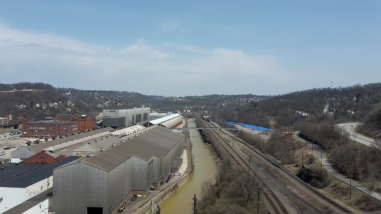
Hydrologically, Monroeville serves as a primary collection bowl for the Turtle Creek Watershed, a 147-square-mile drainage basin that empties into the Monongahela River. The municipality's runoff feeds several serious tributaries, including Abers Creek, Thompson Run, and Pitcairn Run. Before the suburban boom of the 1950s, the agrarian absorbed rainfall, releasing it slowly into these streams. The rapid transformation of Patton Township into a commercial hub replaced permeable soil with square miles of impervious asphalt, parking lots, driveways, and roofs. This alteration destroyed the natural hydrograph. Instead of a slow release, rain events trigger immediate, high-velocity discharge into the valleys, turning placid creeks into destructive torrents within minutes.
The environmental cost of the region's industrial heritage is most visibly stamped on the water quality of Thompson Run. While Pennsylvania streams run orange with iron oxide from Acid Mine Drainage (AMD), Thompson Run frequently exhibits a shocking, milky-blue hue. This coloration signals high concentrations of aluminum, leached from the abandoned Oak Hill No. 4 and No. 5 mines. As groundwater floods these subterranean chambers, it reacts with pyrite and aluminosilicate minerals, creating a toxic cocktail that sterilizes the stream of aquatic life. The Chalfant Run/Thompson Run Watershed Association has documented these discharges extensively, noting that the aluminum precipitates coat the stream bed, smothering the benthic macroinvertebrates that form the base of the food web. Remediation requires passive treatment systems significantly more complex than those used for simple iron removal, demanding large limestone beds to raise the pH and force the metals out of solution.
Flood management remains the central operational directive for the municipality's engineering department. The topography creates a "bathtub effect" in the lower valleys, where water accumulates faster than the narrow stream channels can evacuate it. This was brutally demonstrated during the remnants of Hurricane Ivan in 2004 and again during the record-breaking precipitation of 2018 and 2019. In these events, the volume of water overwhelmed the culverts designed in the mid-20th century, leading to infrastructure failure and property inundation. The response has been a shift from "conveyance", moving water downstream as fast as possible, to "retention," holding water on-site.
Major Hydrological and Geological Events (1954, 2024)
Year
Event
Impact on Monroeville Infrastructure
1954
Hurricane Hazel
Widespread flooding in Turtle Creek valley; early channelization efforts.
2004
Hurricane Ivan
Catastrophic flooding; exposed insufficient culvert sizing in commercial districts.
2009
Flash Floods
Severe damage to Abers Creek infrastructure; prompted updated stormwater ordinances.
2018
Record Rainfall
Saturation of Pittsburgh Red Beds triggered multiple landslides along steep slopes.
2023
Ordinance 2779
Implementation of strict Steep Slope and Landslide Prone Overlay districts.
2024
MS4 Compliance
Enhanced testing of outfalls for illicit discharges and sediment load reduction.
The regulatory framework governing this water management is the Municipal Separate Storm Sewer System (MS4) permit, enforced by the Pennsylvania Department of Environmental Protection (DEP). As of the 2023-2028 permit pattern, Monroeville faces requirements to reduce sediment and nutrient loads. The municipality operates a vast network comprising over 3, 600 storm sewer pipes and 34 detention facilities. Compliance is not administrative; it involves the physical removal of tons of sediment from catch basins and the enforcement of illicit discharge. The DEP mandates require the municipality to map and monitor every outfall where storm sewers empty into surface waters, holding local officials accountable for the water quality entering the Turtle Creek system.
Downstream consequences of Monroeville's water management are severe. The runoff generated by the Miracle Mile and the Monroeville Mall complex travels south, contributing to the flow that reaches the historic Westinghouse Floodgates in East Pittsburgh. While those gates were built to stop the Monongahela from backing up, they offer little protection against flash floods roaring down from the headwaters. Consequently, Monroeville's modern stormwater ordinances require new developments to manage the "rate and volume" of runoff, ensuring that post-development discharge does not exceed pre-development levels for the 2-year through 100-year storm events. This engineering standard aims to decouple the region's economic growth from the hydraulic load placed on the watershed.
By 2026, the focus has shifted toward climate resilience. The frequency of high-intensity, short-duration storms has exposed the limitations of infrastructure built on 1960s rainfall data. The engineering department prioritizes the restoration of natural floodplains where possible and the retrofitting of older detention basins to function as bio-retention cells. These systems use vegetation and soil media to filter pollutants and promote infiltration, attempting to mimic the hydrologic function of the agrarian land that existed prior to 1951. The battle against the geology is constant; the Red Beds wait for saturation, and the mines wait to release their acidic load, requiring a vigilance that defines the modern municipal administration.
The Miracle Mile: Post-War Retail Sprawl and Zoning
Municipal Incorporation and Home Rule Charter Governance
The transformation of Monroeville from a quiet agrarian patchwork into the defining archetype of Pennsylvania suburban sprawl hinges on a single infrastructure event: the October 1951 opening of the Pennsylvania Turnpike's Pittsburgh Interchange. Before this moment, the area remained Patton Township, a rural jurisdiction of dirt roads and coal patches. The interchange, Exit 6 (later Exit 57), acted as a high-pressure nozzle, spraying vehicular traffic and commercial demand directly onto the William Penn Highway (U. S. Route 22). This logistical connection did not alter the local economy; it obliterated the existing rural order and replaced it with a tax base dependent on asphalt, neon, and the automobile.
Don M. Casto Sr., a developer from Columbus, Ohio, recognized the chance of this traffic funnel before local officials fully grasped the. Casto, frequently credited with refining the modern shopping center concept, secured a 30-acre tract of flat land, a geological rarity in the rugged Allegheny plateau, along the newly widened highway. In November 1954, Casto and his son, Don Casto Jr., alongside partner Joseph Skilken, opened the Miracle Mile Shopping Center. It was not the shopping center in the region, yet it was the most ambitious. The complex launched with 26 stores and quickly expanded to 47, encompassing 450, 000 square feet of retail space. Marketing materials from 1954 boasted it was the largest shopping center between New York and Chicago, a claim that, while hyperbolic, signaled the of Monroeville's ambition.
The Miracle Mile differed fundamentally from the traditional business districts of nearby Pitcairn or Turtle Creek. Those older towns featured walkable main streets with storefronts butting against sidewalks. The Miracle Mile was an island of retail surrounded by a sea of asphalt, designed exclusively for the car. Anchor tenants at inception included J. C. Penney, W. T. Grant, Kroger, and Sun Drug. The S. S. Kresge Company operated a prominent dime store, serving as a precursor to the big-box dominance that would follow decades later. This design forced a shift in consumer behavior; shopping became a logistical operation involving a trunk and a parking space rather than a pedestrian social activity.
Local governance scrambled to adapt to the commercial explosion. Patton Township incorporated as the Borough of Monroeville in 1951, a political maneuver intended to secure control over the surging tax revenue and zoning powers. The initial zoning ordinances established in the early 1950s codified the "commercial strip" model. Council members and planning commissioners, prioritizing rapid economic growth over town planning, zoned the frontage of Route 22 almost exclusively for commercial use. This decision created the "Neon Jungle," a chaotic linear district of car dealerships, motels, diners, and furniture stores that stretched for miles. The zoning banned the development of a civic town center, ensuring that Monroeville's identity would forever be tied to the highway strip.
Traffic counts on Route 22 exploded throughout the late 1950s, necessitating the widening of the highway to four lanes in 1959. This infrastructure upgrade further entrenched the dominance of the Miracle Mile. By 1960, the borough's population had more than doubled from its 1950 levels, driven by families fleeing Pittsburgh's industrial smoke for the convenience of the suburbs. The Miracle Mile served as the de facto downtown for this new population. It was the place where residents bought groceries at Kroger, clothes at Penney's, and prescriptions at Sun Drug. The parking lot itself became a social hub, a phenomenon that peaked during the "cruising" culture of the 1960s and 1970s.
The retail hegemony of the Miracle Mile faced its serious threat in 1969 with the opening of the Monroeville Mall, a massive enclosed complex located just a few miles away. The Mall, developed by Oxford Development Company, siphoned off the premier department stores, including the J. C. Penney anchor, which relocated to the climate-controlled. Conventional wisdom suggested the open-air strip center would wither. Yet, the Miracle Mile demonstrated a remarkable resilience that retail trends. The owners pivoted, replacing high-end fashion anchors with value-oriented retailers and category killers. By the 1980s and 1990s, the center had backfilled vacancies with tenants like Service Merchandise and Media Play, evolving into what the industry classifies as a "power center."
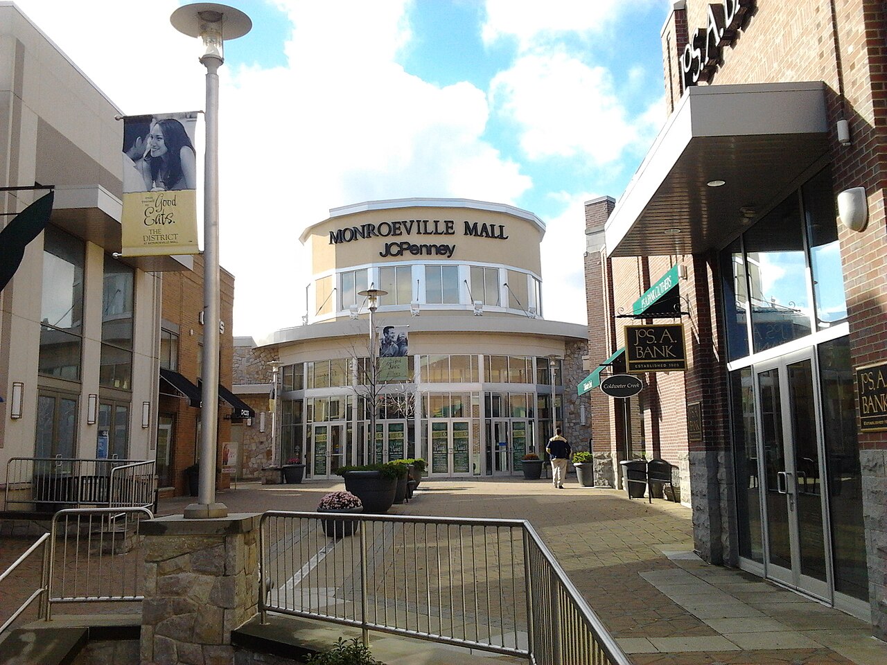
This adaptability proved crucial as the retail sector entered the 21st century. While enclosed malls began a slow death spiral due to e-commerce and changing tastes, the Miracle Mile's open-air format and convenience-focused tenant mix kept occupancy high. In November 2017, Chicago-based real estate firm M & J Wilkow, in a joint venture with Alto Real Estate Funds, purchased the property for $78 million. At the time of the sale, the center boasted a 98 percent occupancy rate, anchoring its rent roll with national chains such as Marshalls, Old Navy, DSW, and LA Fitness. The center's valuation reflected its status as a high-performing asset in a volatile market.
The between the Miracle Mile and the Monroeville Mall became clear clear in the mid-2020s. By January 2025, the Monroeville Mall, once the crown jewel of the region, was sold to Walmart for a mere $34 million, less than half the 2017 value of the Miracle Mile. Walmart announced plans to demolish the mall for a supercenter, marking the end of the enclosed mall era in the municipality. In sharp contrast, M & J Wilkow listed the Miracle Mile for sale in July 2025, marketing it as a stabilized, "dominant regional shopping destination" with near-full occupancy. The strip center had outlived the mall that was built to replace it.
Current data from 2026 indicates that the Miracle Mile remains the economic engine of the Route 22 corridor. The center generates significant mercantile tax revenue for the municipality and the Gateway School District. Yet, the zoning decisions of the 1950s continue to dictate the borough's challenges. The absence of pedestrian infrastructure along the corridor makes the area hostile to non-motorized traffic, and the reliance on a single commercial artery leaves the municipality to traffic congestion and road maintenance costs. The "Miracle Mile" is no longer just a name for a shopping center; it is the historic label for a sixty-year experiment in auto-centric urban planning that prioritized speed and sales volume above all else.
Comparative Retail Evolution: Miracle Mile vs. Monroeville Mall (1954, 2026)
Feature
Miracle Mile Shopping Center
Monroeville Mall
Opening Date
November 1954
May 1969
Original Developer
Don M. Casto Jr. / Joseph Skilken
Oxford Development Company
Format
Open-air Strip / Power Center
Enclosed Regional Mall
Key Anchor History
J. C. Penney (Left 1969), Kroger, Sun Drug
Gimbels, Horne's, J. C. Penney (Arrived 1969)
2017 Valuation/Sale
Sold for $78 Million (M & J Wilkow)
Valuation in decline (CBL Properties owned)
2025 Status
Listed for sale (July);>95% Occupancy
Sold to Walmart ($34M); Slated for Demolition
Primary 2026 Tenants
Marshalls, Old Navy, LA Fitness, DSW
Walmart Supercenter (Planned/Construction)
Monroeville Mall: Commercial Operations and Cinematic History
The transformation of the Monroeville terrain from subterranean coal extraction to retail dominance represents one of the most aggressive alterations of topography in Allegheny County history. Before 1966, the site occupied by the Monroeville Mall was known as Harper's Mine, a rugged tract of land defined by deep excavation and industrial scarring. To render this 280-acre parcel usable for commercial development, Don-Mark Realty (later Oxford Development Company) executed a massive grading operation. Engineers moved approximately five million cubic yards of earth to level the site, a logistical feat that cost $2. 5 million in 1960s currency. This terraforming project prepared the foundation for what would become, at the time of its opening in May 1969, the largest enclosed shopping complex in the United States.
The mall opened as a 1. 13 million-square-foot of consumerism, anchored by Pittsburgh retail giants Gimbels and Joseph Horne Co., with JCPenney occupying the center court. The interior design reflected the optimism of mid-century commerce, featuring the "Ice Palace," a regulation-sized skating rink surrounded by restaurants with viewing windows. This feature, along with the animatronic Clock of Nations and extensive indoor flora, established the mall not as a point of transaction as a civic center for the eastern suburbs. The facility drew traffic away from the earlier Miracle Mile Shopping Center and contributed to the rapid decline of the East Hills Shopping Center in Penn Hills, centralizing regional commerce within Monroeville's borders.
The cultural significance of the Monroeville Mall transcends its retail metrics due to its central role in George A. Romero's 1978 film, Dawn of the Dead. Filmed during the winter of 1977-1978, the production used the mall's suspended state during overnight hours to critique the mindless consumption of the era. Romero's zombies, wandering the concourses to the Muzak rhythms of "The Gonk," cemented the location in cinematic history. The film documented specific architectural features that have since been erased, including the original clock tower, the brown-tiled fountains, and the Ice Palace itself. While the skating rink was removed in 1984 to create a food court, the structure remains a pilgrimage site for horror enthusiasts, generating a niche tourism economy that even as the mall's commercial viability waned.
Commercial operations remained strong through the 1990s, driven by the consolidation of department stores. The Gimbels location transitioned to Kaufmann's in 1987, while Horne's became Lazarus in 1994 and eventually Macy's in 2005. In 2004, CBL & Associates Properties purchased the mall for $231 million, a valuation that reflected its status as a prime asset. CBL initiated a significant expansion, adding "The District," an open-air lifestyle center, and renovating the interior to modernize its aesthetic. This period marked the peak of the mall's valuation and regional influence before the onset of the "retail apocalypse" that would the dominance of enclosed shopping centers nationwide.
The trajectory of the mall shifted violently on February 7, 2015. A targeted shooting inside the Macy's department store left three people injured and shattered the perception of safety that is essential for a family-oriented retail environment. In response, mall management implemented a "Youth Escort Policy" (PGR), requiring visitors under 18 to be accompanied by an adult on weekend evenings. While the policy aimed to curb loitering and disturbances, the reputational damage proved difficult to reverse. The incident, combined with the broader decline of brick-and-mortar retail, accelerated the facility's downward spiral. Anchor tenants struggled; JCPenney filed for bankruptcy in 2020, though the Monroeville location remained open, while other retailers like Sears (which had a presence nearby) and smaller inline stores vacated the premises.
Financial records from 2020 to 2024 show a precipitous drop in the asset's value. CBL & Associates filed for Chapter 11 bankruptcy in November 2020, emerging in 2021 with a restructured portfolio that still struggled with debt. By late 2023, the Monroeville Mall was marketed for sale, a clear signal that the era of the enclosed regional mall in this location had ended. The vacancy rate climbed as national chains liquidated, leaving large sections of the concourse empty or occupied by temporary, non-traditional tenants.
The definitive end of the mall as a traditional retail entity arrived in early 2025. In a transaction that stunned local observers, CBL sold the entire 186-acre property, including the mall and several outparcels, to Walmart (via a subsidiary, South Saturn Ridge LLC) for a mere $34 million. This sale price, roughly 15% of the $231 million CBL paid in 2004, illustrates the catastrophic depreciation of enclosed mall assets. Walmart's acquisition was not an attempt to save the structure to clear it. Filings with the Pennsylvania Redevelopment Assistance Capital Program (RACP) in late 2025 revealed Walmart's intent to demolish the 1. 2 million-square-foot complex. The plan, dubbed the "Monroeville Mall Gateway," outlines the construction of a new Supercenter, a Sam's Club, and a mixed-use open-air development.
As of early 2026, the mall exists in a "dead mall walking" state. Tenants have been issued notices to vacate by April 2027, creating an atmosphere of uncertainty for the remaining small business owners. The Living Dead Museum, a tenant that capitalized on the Romero legacy, faces displacement once again. The impending demolition marks the closing of a 57-year economic pattern: the mall that once destroyed local main streets is being cannibalized by the big-box model that superseded it.
Monroeville Mall: Valuation and Ownership Timeline (1969, 2026)
Year
Event/Status
Key Financial/Operational Metric
1969
Grand Opening
Cost: ~$30 Million (Construction)
1984
Renovation
Ice Palace removed; Food Court added
2004
Acquisition by CBL & Associates
Sale Price: $231 Million
2012-2013
Anchor Shuffle
JCPenney moves to former Boscov's; Cinemark built
2015
Security emergency
Shooting incident; Youth Escort Policy enacted
2020
Corporate Bankruptcy
CBL files Chapter 11; Asset value written down
2025
Sale to Walmart
Sale Price: $34 Million (Cash deal)
2026
Pre-Demolition Status
Demolition scheduled for 2027; Tenants vacating
The cinematic legacy of the site remains its most enduring export. While the physical structure is slated for destruction, the imagery of the Monroeville Mall in Dawn of the Dead serves as a permanent archival record of late-20th-century consumer culture. The where the protagonists blocked the zombie horde, the boiler room corridors, and the specific layout of the 1978 concourse are preserved in digital formats, even as the physical steel and concrete await the wrecking ball. The transition from Harper's Mine to the Mall and soon to a Walmart Supercenter reflects the relentless, frequently destructive, evolution of American commercial real estate.
Westinghouse Electric Company and Nuclear Sector Employment
Geological Topography and Turtle Creek Watershed Management
The transformation of Monroeville from a post-war suburb into a global nerve center for atomic energy began in the late 1960s, marking a definitive shift in the municipality's economic identity. For nearly four decades, the **Westinghouse Electric Company** operated its Nuclear Energy Systems headquarters from the **Monroeville Energy Center**, a sprawling complex that anchored the region's high-tech employment sector. This facility did not house administrative offices; it served as the intellectual cockpit for the pressurized water reactor (PWR) technology that powers a significant plurality of the world's commercial nuclear fleet. Construction of the Energy Center commenced in late 1968, driven by the need to consolidate Westinghouse's dispersed nuclear division, which had outgrown its facilities in neighboring Forest Hills and Churchill. Completed in 1971, the site at **4350 Northern Pike** became a landmark of corporate modernism. The complex featured two four-story towers connected by a central atrium, encompassing over 505, 000 square feet of office and laboratory space. At its zenith, the Energy Center housed between 2, 500 and 3, 000 employees, a workforce dominated by nuclear physicists, thermal-hydraulic engineers, and project managers. These workers commanded salaries significantly above the regional median, creating a multiplier effect that sustained Monroeville's housing market and retail sector through the industrial collapse that devastated the rest of the Mon Valley in the 1980s. The work conducted within the Monroeville Energy Center had global ramifications. During the 1970s and 1980s, engineers at the site oversaw the design and licensing of dozens of nuclear plants across the United States, Europe, and Asia. Even as the domestic nuclear industry stagnated following the Three Mile Island accident in 1979, the Monroeville teams pivoted toward servicing the operating fleet and developing advanced reactor designs. The **AP600** and the early stages of the **AP1000** reactor, designs characterized by passive safety systems, were conceptualized and refined within these walls. Consequently, Monroeville functioned as the capital of the Western world's nuclear engineering sector for a generation. The relationship between the municipality and the corporate giant shifted dramatically in the 21st century. In 2007, citing the "nuclear renaissance" and a need for a larger, more unified campus to accommodate rapid hiring, Westinghouse announced its intention to relocate its global headquarters. even with aggressive retention efforts by Allegheny County and Monroeville officials, the company selected a greenfield site in **Cranberry Township**, Butler County. The decision was driven by tax incentives and the desire for a custom-built facility capable of housing 4, 500 employees. The relocation process, executed between 2009 and 2012, resulted in the complete vacating of the Northern Pike facility. The departure of Westinghouse represented a seismic economic shock to Monroeville. The municipality lost its single largest employer and a substantial portion of its Local Services Tax (LST) revenue. The vacancy of a half-million-square-foot, single-tenant facility created a "dark anchor" effect, depressing commercial real estate values in the immediate vicinity. For nearly a decade, the site stood largely empty, a physical symbol of the region's economic drift from the eastern suburbs to the booming northern corridor. The loss was compounded by the concurrent contraction of the retail sector, as the Monroeville Mall, another major tax generator, began to face headwinds from e-commerce and changing consumer habits.
The following table outlines the operational timeline of the Monroeville Energy Center, tracking its evolution from a nuclear headquarters to a multi-tenant technology campus.
Period
Phase
Key Activity
Primary Occupant
1968, 1971
Construction
Development of the Northern Pike site to consolidate nuclear divisions.
Westinghouse Electric Corp.
1971, 2009
Operational Peak
Global HQ for Nuclear Energy Systems; development of PWR and AP1000 technology.
Westinghouse Electric Co.
2009, 2012
The Exodus
Phased relocation of 3, 000+ employees to Cranberry Woods; facility closure.
Westinghouse (Transitioning)
2012, 2018
Vacancy & Stagnation
Site largely dormant; failed attempts to secure a single large corporate tenant.
None (Vacant)
2019, 2026
Redevelopment
Acquisition by Tier Connect; conversion to mixed-use campus.
BNY Mellon, PSC, AmeriSource Bergen
Redemption for the site arrived in June 2019, when ** Tier Connect**, an investment partnership between Tier HD and RedBird Capital Partners, acquired the property for approximately $18 million. Recognizing that the era of single-tenant corporate had passed, the new owners rebranded the facility as **" Tier Connect , Pittsburgh East"** and repositioned it as a campus for data centers, technical operations, and business continuity. The strategy proved. By 2024, the facility had successfully attracted a diverse roster of high-profile tenants, diversifying the economic risk that had plagued the site under Westinghouse's sole occupancy. **BNY Mellon** established a significant presence for its technical operations, while the **Pittsburgh Supercomputing Center (PSC)** moved its high-performance computing infrastructure to the site, taking advantage of the strong electrical grid originally built to support nuclear engineering labs. Other tenants, such as **AmeriSource Bergen**, filled the remaining office floor plates. This adaptive reuse marked a successful transition from the industrial age to the information age. While the total headcount at the site in 2026 remains lower than the Westinghouse peak of the 1980s, the employment mix is more resilient. The presence of the Supercomputing Center is particularly symbolic; where engineers once calculated neutron flux using mainframes, modern data scientists train artificial intelligence models and simulate protein folding. The Westinghouse legacy in Monroeville is complex. For forty years, the company provided the municipality with a global profile and a stable upper-middle-class tax base. Its departure exposed the vulnerabilities of a suburban economy reliant on a single dominant industry. Yet, the successful repurposing of the Energy Center demonstrates the resilience of Monroeville's infrastructure. The massive power feeds, fiber-optic connectivity, and reinforced floor loads designed for nuclear engineers made the building an ideal host for the digital economy. Even with the loss of the headquarters, the nuclear sector's imprint remains on the local demographics. retired Westinghouse engineers chose to remain in Monroeville, contributing to a population that is older and more technically literate than the national average. The "Westinghouse retiree" remains a distinct sociological category in the municipality, active in local government and civic organizations. also, the intellectual capital developed in Monroeville during the AP1000 design phase continues to influence global energy projects, linking the municipality's history to reactors currently operating in China and under construction in the American South. By 2026, the physical traces of the nuclear giant have been largely scrubbed from the, replaced by the branding of financial services and data logistics. The shuttle buses that once ferried physicists between Monroeville and the Churchill R&D center are gone, and the "Circle W" logo has been removed from the Northern Pike facade. Nevertheless, the Energy Center remains the architectural keystone of Monroeville's commercial corridor, a testament to the era when this suburb was the command center for the atomic age.
Healthcare Infrastructure: Forbes Hospital and UPMC East
For the majority of its recorded history, the area defined as the Municipality of Monroeville possessed no formal healthcare infrastructure. Throughout the 18th and 19th centuries, the region remained a collection of agrarian hamlets where medical care fell to itinerant country doctors or family matriarchs relying on folk remedies. Serious injuries sustained in the coal mines of Patton Township or on the Northern Pike frequently proved fatal due to the distance from Pittsburgh's urban hospitals. The "Golden Hour", the serious window for trauma survival, was a concept that did not apply to the rural residents of the Turtle Creek Valley, who lived hours by wagon from the surgical theaters of the city.
The post-World War II suburban explosion radically altered this. As the population of Monroeville surged from 12, 000 in 1950 to nearly 30, 000 by 1970, the absence of a local hospital became a serious public safety problem. Residents faced long ambulance rides to Braddock, Wilkinsburg, or Pittsburgh for emergency care. In response to this demographic shift, a consolidation of urban medical facilities occurred. The Pittsburgh Hospital in East Liberty and the Columbia Hospital in Wilkinsburg merged their operations to form a new entity capable of serving the eastern suburbs. This initiative culminated in the construction of Forbes Regional Hospital ( AHN Forbes), which opened its doors in 1978 on Haymaker Road. For over three decades, this 349-bed facility stood as the undisputed medical hegemon of the municipality, providing the only full-service inpatient care between Pittsburgh and Westmoreland County.
The healthcare environment in Monroeville shifted violently in the early 2010s, mirroring the fractious split between the region's two dominant healthcare giants: Highmark (which acquired the West Penn Allegheny Health System) and the University of Pittsburgh Medical Center (UPMC). Monroeville became the primary battleground for this corporate rivalry. In a move that permanently altered the municipality's physical and economic structure, UPMC broke ground on a massive new facility directly competing with Forbes. The project, UPMC East, rose on a 16-acre site at the intersection of Route 22 and Route 48 (Mosside Boulevard), less than one mile from the existing Forbes campus.
Completed at a cost of $250 million, UPMC East opened to patients on July 2, 2012. The speed of its construction and its strategic placement signaled an aggressive attempt to capture the eastern suburban market. The seven-story, 300, 000-square-foot hospital launched with 156 private beds, smart-glass technology for patient privacy, and a design focused on efficiency. Its opening ended the monopoly Forbes had held for 34 years and forced an immediate, capital-intensive response from the Allegheny Health Network (AHN). The resulting "medical arms race" transformed Monroeville into a dense hub of advanced medical technology, with two major hospital systems operating within sight of one another.
Forbes Hospital responded to the new competition by upgrading its capabilities to handle cases that UPMC East initially could not. On October 1, 2013, the Pennsylvania Trauma Systems Foundation accredited Forbes as a Level II Trauma Center. This designation made it the and only hospital in the eastern suburbs capable of treating severe, life-threatening injuries, such as those from high-speed vehicle crashes on the Pennsylvania Turnpike or industrial accidents. Prior to this accreditation, severe trauma cases bypassed Monroeville for Pittsburgh's Level I centers. The trauma status anchored Forbes as the destination for serious care, while UPMC East focused heavily on surgical services, emergency medicine, and outpatient volume.
The competition intensified between 2018 and 2026, driving hundreds of millions of dollars in further investment. In 2019, AHN opened a $35 million Cancer Institute at Forbes, a 63, 000-square-foot standalone facility designed to keep oncology patients within the municipality rather than traveling to the city. Simultaneously, UPMC East initiated a series of expansions to address capacity constraints. By August 2020, UPMC East completed a $24 million expansion of its emergency department, doubling its size to 30, 000 square feet and increasing the number of exam rooms from 24 to 44. This expansion was necessary to manage patient volumes that had outstripped original projections within a decade of opening.
The economic impact of this dual-hospital system on Monroeville is. As of 2024, the "Health Care and Social Assistance" sector stands as the municipality's largest employer, supporting over 3, 000 jobs. The concentration of medical facilities along the Route 22 corridor has created a "Medical Mile," attracting ancillary services such as imaging centers, private practices, and rehabilitation clinics. Even with the benefits of high employment, the municipality faces challenges regarding property tax revenue, as the core hospital operations for both non-profit giants are tax-exempt, placing the load of maintaining the heavy-traffic infrastructure on residential and commercial taxpayers.
By early 2026, the two hospitals had settled into a high- equilibrium. Forbes maintained its dominance in trauma, obstetrics, and high-acuity inpatient care, operating with approximately 350 beds. UPMC East continued to capture significant market share in elective surgery and emergency visits, maintaining high occupancy rates for its ~156 beds. This duplication of services, while criticized by health economists as inefficient, guarantees that Monroeville residents possess access to world-class medical technology that was unimaginable during the township's agrarian Patton era.
Comparative Medical Infrastructure: Monroeville (2026 Status)
Feature
AHN Forbes Hospital
UPMC East
Opening Year
1978
2012
Location
Haymaker Road
Mosside Blvd (Rt 48) & Rt 22
Bed Count
~349
~156
Trauma Level
Level II (Accredited 2013)
Non-Trauma Center
Key Specialty
Trauma, High-Risk Obstetrics, NICU
Surgery, Emergency Medicine, Stroke
Recent Investment
$35M Cancer Center (2019)
$24M Emergency Dept Expansion (2020)
Gateway School District: Enrollment Data and Tax Levies
The Miracle Mile: Post-War Retail Sprawl and Zoning
The Gateway School District serves as the educational and fiscal nexus for the Municipality of Monroeville and the neighboring Borough of Pitcairn. Established in its modern form in 1958, the district represents a consolidation of the agrarian-turned-suburban Patton Township schools and the industrial, railroad-centered Pitcairn system. This union created a socio-economic cross-section that distinguishes Gateway from other Allegheny County suburban districts. The district operates under a unified tax levy, binding the property owners of both municipalities to a single financial structure even with their distinct municipal identities. The district's formation in the mid-20th century coincided with Monroeville's explosive residential growth. In 1955, the school boards of Monroeville and Pitcairn agreed to a joint operation, culminating in the opening of Gateway Senior High School in September 1958. The campus-style high school, located on the "Gateway Campus" boulevard, became the physical symbol of the new suburban identity. For decades, the district expanded to accommodate the baby boom generation, constructing multiple elementary schools and the Moss Side Middle School. By the 1970s, enrollment peaked, reflecting the dense suburbanization of the region. Demographic shifts in the 21st century have fundamentally altered the district's composition. While the district remained predominantly white through the 1990s, data from the 2023-2024 school year shows a student body that is approximately 44% White, 31% Black, 7% Asian, and 11% multiracial. This diversity stands in contrast to the older demographic profiles of the municipality. The economic profile of the student base has also shifted; as of 2024, approximately 57% of students are classified as economically disadvantaged. This change drove the controversial decision in 2011 to close Pitcairn Elementary, a move that consolidated all elementary students into Monroeville-based buildings and ended the era of neighborhood schools in the borough. Financial management and tax levies remain the most contentious aspects of the district's administration. The district relies heavily on real estate taxes, creating a direct tension between the school board's budgetary needs and the property owners' financial capacity. For the 2024-2025 fiscal year, the board approved a budget of approximately $94. 8 million, necessitating a tax hike to 24. 0684 mills. This upward trajectory continued into the 2025-2026 planning pattern. In May 2025, the board moved to adopt a $98. 1 million budget, pushing the millage rate to 25. 2718 mills. This rate means a property owner with a home assessed at $100, 000 faces an annual school tax bill of roughly $2, 527, exclusive of municipal and county taxes. The following table details the recent history of tax levies and budgetary growth for the Gateway School District:
Fiscal Year
Millage Rate
Budget Total (Approx.)
Key Financial Drivers
2020-2021
20. 46 mills
$88. 0 Million
Pension obligations, charter school tuition costs.
2022-2023
21. 85 mills
$90. 5 Million
Inflationary pressures, special education funding gaps.
2024-2025
24. 07 mills
$94. 8 Million
Contractual salary increases, declining state reimbursement ratios.
2025-2026
25. 27 mills
$98. 1 Million
Use of $372, 000 from fund balance, rising operational costs.
The district's financial is exacerbated by the "adequacy gap" in state funding. In 2025, Superintendent Guy Rossi noted that while 348 Pennsylvania districts received specific "adequacy gap" funding to aid underfunded systems, Gateway was among the 152 that did not, even with its high percentage of economically disadvantaged students. This exclusion forces the district to rely more aggressively on local property taxes to the gap between rising operational costs, specifically in special education and charter school reimbursements, and stagnant state aid. Enrollment numbers have stabilized around 3, 400 to 3, 500 students in the mid-2020s, a decline from the overcrowding of the 1970s a steady figure compared to the sharp drops seen in other Rust Belt suburbs. The district maintains six buildings: Gateway High School, Gateway Middle School, and four elementary schools (Evergreen, Ramsey, University Park, and Dr. Cleveland Steward Jr.). The high school continues to serve as a regional hub, offering extensive Advanced Placement courses and a strong athletic program that competes in the WPIAL Class 5A division. The relationship between the district and the Municipality of Monroeville is symbiotic yet distinct. While the Municipality collects a separate 5. 5 mill tax for services like police and road maintenance, the School District's levy is nearly five times higher, making it the primary driver of the local cost of living. This frequently leads to public scrutiny of school board spending, particularly regarding administrative salaries and capital projects, such as the renovations to the high school complex and the sports facilities. The load falls equally on the residents of Pitcairn, whose lower average property values frequently result in a higher relative tax effort compared to the wealthier subdivisions of Monroeville.
Transportation Logistics: I-376 and Pennsylvania Turnpike Interchange
The defining feature of Monroeville's modern existence is not its soil, its concrete. While the municipality's agrarian roots in Patton Township relied on the slow pace of the plow, its transformation into a commercial colossus was engineered by the Pennsylvania Turnpike Commission and the Pennsylvania Department of Highways. The convergence of Interstate 76 (the Pennsylvania Turnpike) and Interstate 376 (the Parkway East) within Monroeville's borders created a logistical vortex that sucked commerce out of downtown Pittsburgh and deposited it onto the William Penn Highway. This infrastructure did not serve the population; it manufactured it.
Long before the interstates, the geography of the region dictated the flow of movement. The Northern Pike, completed in 1807, and the original William Penn Highway (an auto trail established in 1916) followed the high ridges to avoid the swampy valley floors of Turtle Creek. These early arteries established Monroeville as a waypoint rather than a destination. Travelers stopped to rest before the final descent into Pittsburgh or the long haul toward Philadelphia. The true logistical revolution arrived on August 7, 1951. On this date, the Pennsylvania Turnpike Commission opened the Western Extension of the toll road from Irwin to the Ohio state line. For Monroeville, this was the moment of ignition. The interchange, originally Exit 6 and later renumbered Exit 57, was named the "Pittsburgh Interchange." This label was a geographical lie that became an economic truth: to get to Pittsburgh from the east, one had to go through Monroeville.
The opening of the Turnpike fundamentally altered the land value of the adjacent farming tracts. The traffic volume funneled into the intersection of Route 22 and Route 48 created an immediate demand for services. The "Miracle Mile" shopping district, which broke ground in 1954, was a direct downstream consequence of the Turnpike exit. It was the instance in the region where a highway interchange acted as the primary architect of a town center. The heavy flow of post-war automobiles required wide berths, massive parking lots, and service stations, obliterating the pedestrian of the old farming village. The Turnpike did not just bring cars; it brought a new geometric logic to the, defined by high-speed entry ramps and grade-separated.
The second phase of this logistical encirclement occurred a decade later. While the Turnpike brought cross-state traffic, the connection to Pittsburgh remained a choked ordeal along the commercialized Route 22. This changed on October 27, 1962, with the completion of the Penn-Lincoln Parkway ( I-376) extension from Churchill to Monroeville. This 4. 5-mile segment bridged the gap between the urban core and the toll road. The engineering required to cut this highway through the rugged Allegheny plateau was immense, involving deep rock cuts and high viaducts that severed local roads like Old William Penn Highway and McCully Road. The completion of the Parkway East hardwired Monroeville into the Pittsburgh metropolitan organism. It allowed steelworkers and corporate managers to live in the expanding subdivisions of Garden City and commute to the mills or the Golden Triangle in under thirty minutes, at least, in theory.
By the 1980s and 1990s, the theoretical efficiency of this interchange system collided with the reality of induced demand. The "Squirrel Hill Tunnel," located miles to the west, became a notorious bottleneck that sent shockwaves of congestion backward into Monroeville. The I-376/Turnpike interface became one of the busiest freight corridors in the Commonwealth. Average Daily Traffic (ADT) counts on the Parkway East method Monroeville frequently exceeded 80, 000 vehicles, while the Turnpike carried tens of thousands of heavy trucks daily. The infrastructure designed for 1960s volumes began to crumble under 21st-century loads. The, built with a lifespan of fifty years, entered a phase of serious structural deficiency.
The logistical narrative of the 2020s has been defined by frantic rehabilitation and the digital shift in tolling. In 2020, the Pennsylvania Turnpike Commission accelerated the move to All-Electronic Tolling (AET), removing the physical toll booths that had stood as gateways since the Truman administration. This shift to "Open Road Tolling" was intended to reduce the queueing that frequently spilled onto Route 22, yet it did not solve the physical limitations of the roadway width. The Turnpike Commission initiated a long-term widening project to expand the highway from four to six lanes, a massive undertaking involving the total reconstruction of the road base.
As of 2026, the region is in the grip of the $70. 1 million "Parkway East Betterment Project." This initiative, managed by PennDOT, represents the most significant intervention on the I-376 corridor in decades. The project focuses on the 4. 5-mile stretch between Churchill and Monroeville, specifically targeting the aging over Old William Penn Highway. Throughout 2025 and 2026, motorists navigated complex traffic crossovers and lane restrictions as crews replaced the superstructures of these serious spans. The work, scheduled for completion in the fall of 2026, aims to extend the life of the highway for another generation, though it does not add capacity to the lane-constrained corridor.
Simultaneously, the Turnpike Commission faces the "Milepost 49-53" reconstruction project in the neighboring Oakmont and Plum boroughs, which directly impacts the flow into Monroeville. yet, the planned widening of the Turnpike between Monroeville (Milepost 57) and Irwin (Milepost 67) faced delays in the mid-2020s due to flat traffic projections and funding constraints. This delay leaves a bottleneck in the six-lane system, forcing high-speed traffic to merge down to two lanes in each direction exactly where the volume is highest.
Major Infrastructure Milestones: Monroeville Logistics (1951, 2026)
Year
Event
Logistical Impact
1951
PA Turnpike Western Extension Opens
Monroeville becomes the "Pittsburgh Interchange" (Exit 6).
1954
Miracle Mile Construction
Direct commercial exploitation of Turnpike traffic volume.
1962
Parkway East (I-376) Completion
Direct high-speed link established to Downtown Pittsburgh.
2020
Cashless Tolling Implementation
Removal of physical toll booths; shift to gantry systems.
2024
I-376 Betterment Project Begins
$70. 1M rehabilitation of and road surface.
2026
Replacement Completion
New superstructures over Old William Penn Hwy fully operational.
The "missing link" in Monroeville's transportation history remains the Mon-Fayette Expressway (PA Route 43). Conceived in the 1960s to connect the steel towns of the Monongahela Valley to the Parkway East, the northernmost leg of this project was intended to terminate in Monroeville. For decades, this proposed highway appeared on planning maps, promising to divert heavy truck traffic away from the congested Squirrel Hill Tunnel corridor. By 2026, while the southern sections of the expressway near Jefferson Hills saw construction, the final connection to Monroeville remained in a state of suspended animation, funded in theory stalled by the immense cost of land acquisition and the engineering difficulty of threading a new four-lane highway through the densely developed suburbs.
The interchange at Monroeville is more than a junction of asphalt; it is a barometer of the region's economic health. When the steel mills collapsed in the 1980s, the traffic counts in Monroeville did not drop; they shifted composition, as the borough transitioned from a bedroom community for industrial workers to a regional hub for healthcare and retail. The trucks that rumble through Exit 57 today are less likely to carry raw ingots and more likely to carry Amazon parcels, yet the concrete they drive on is a legacy of the industrial age, constantly patched and widened to accommodate a future that arrived faster than the planners anticipated.
Demographic Trends and Housing Market Valuation (1970, 2026)
Monroeville Mall: Commercial Operations and Cinematic History
The demographic trajectory of the Municipality of Monroeville from 1970 to 2026 represents a classic case study of the American inner-ring suburb. This period captures the transition from a booming, white-flight destination to a mature, diverse, and economically stratified jurisdiction. While the agrarian Patton Township of the 1700s defined the land for two centuries, the housing developments of the mid-20th century obliterated those farms to house the steel management class. By 2026, the municipality faces the complex reality of an aging housing stock, a shrinking population, and a radical shift in racial and economic composition. In 1970, Monroeville stood at the apex of its explosive growth. The opening of the Monroeville Mall in 1969 served as the economic engine that drove residential demand, transforming the area into the premier eastern suburb of Pittsburgh. The 1970 Census recorded a population of 29, 011, a figure that surged to its historical peak of 30, 977 by 1980. During this decade, the municipality functioned as a bedroom community for families fleeing the industrial decline of the city. The housing market responded with a construction frenzy; the median construction year for a home in Monroeville today remains 1969, a statistic that permanently anchors the municipality's architectural identity in the split-level and ranch-style aesthetics of the Nixon era. The collapse of the regional steel industry in the 1980s halted this expansion. unlike the mill towns of the Monongahela Valley, Monroeville did not suffer an immediate population crash, it did enter a long period of stagnation. By 1990, the population dipped to 29, 169. The young families who arrived in the 1960s began to age in place, and their children moved away for economic opportunities elsewhere. This "graying" of the suburb became the dominant demographic narrative of the 1990s and 2000s. By the 2000 Census, the median age had climbed significantly, and the percentage of households with children under 18 began a steady decline that to the present day. The most significant transformation occurred between 2000 and 2026 regarding racial demographics. In 2000, Monroeville was 85. 58% White, 8. 29% African American, and 4. 41% Asian. Over the quarter-century, these ratios shifted dramatically. As of early 2026, data indicates the White population has decreased to approximately 69. 2%, while the African American population has nearly doubled to 15. 3%. The Asian population also saw strong growth, rising to over 5. 2%, anchored largely by the cultural of the Sri Venkateswara Temple, which attracts South Asian professionals to the area. This diversification mirrors national trends for inner-ring suburbs, yet it also presents new challenges for the Gateway School District, which has seen its student body become majority-minority and economically disadvantaged rates climb to 57. 1% by 2024.
The following table illustrates the demographic and economic shifts within the municipality over a 26-year period, contrasting the turn of the millennium with current data.
Metric
2000 Census Data
2024-2026 Estimates
Percent Change / Shift
Total Population
29, 349
27, 622 (Proj.)
-5. 8%
Median Age
41. 5 Years
44. 0 Years
+6. 0%
White Population
85. 6%
69. 2%
-16. 4 pts
Black Population
8. 3%
15. 3%
+7. 0 pts
Asian Population
4. 4%
5. 6%
+1. 2 pts
Median Home Value
$108, 000 (approx)
$265, 000
+145% (Nominal)
The housing market from 2020 to 2026 experienced volatility unseen since the 1970s boom. The COVID-19 pandemic triggered a scramble for single-family homes, driving prices upward even with the municipality's aging inventory. In January 2026, the median home sale price reached $265, 000, a 16. 5% increase year-over-year. This surge occurred even with a population decline of roughly 0. 62% annually. The disconnect between shrinking population and rising home prices suggests a decrease in household size, more singles and childless couples occupying three-bedroom homes, and a severe absence of new construction. With 95% of the land already developed, new housing starts are negligible, forcing buyers to compete for the existing 1960s and 1970s stock. Market analysis for early 2026 classifies Monroeville as a "buyer's market," a reversal from the frenetic seller's market of 2021-2023. Inventory sits on the market longer, with an average of 63 days to sell in early 2026 compared to 57 days the prior year. This cooling effect correlates with high interest rates and the "sticker shock" of recent county-wide property assessments. The tax load remains a contentious matter; as the commercial sector faces headwinds from the decline of brick-and-mortar retail (symbolized by the struggles of Monroeville Mall), the residential tax base faces increased pressure to fund municipal services and the school district. The rental market has also evolved. While Monroeville was designed primarily for owner-occupied housing, the 2020s saw an increase in the conversion of single-family homes into rentals by corporate landlords, alongside the construction of luxury apartment complexes near the Turnpike interchange. By 2025, the median rent hovered around $1, 790, a figure that prices out service workers employed in the very retail corridors that define the town's economy. This economic stratification creates a duality in the municipality: a wealthy, aging class of homeowners who bought decades ago, and a younger, more diverse transient population facing high blocks to entry. Gateway School District enrollment numbers serve as a leading indicator for these housing trends. Enrollment has dropped from over 5, 000 in the peak years to approximately 3, 486 in 2024. The district's capacity, built for the Baby Boom generation, exceeds the student population, leading to consolidation discussions. The correlation between school ratings and property values remains tight; as the district's demographic profile shifted, wealthier families migrated to exurbs like Murrysville (Westmoreland County) to escape Allegheny County taxes and perceived school decline, repeating the pattern of flight that originally populated Monroeville in the 1950s. Looking toward the latter half of the 2020s, Monroeville occupies a precarious position. It is no longer the "frontier" of development it was in 1790, nor the booming suburb of 1970. It is a mature municipality managing decline. The housing stock, method 60 years old, requires significant capital investment for modernization. The population is projected to continue a slow contraction, stabilizing around 27, 500. The challenge for municipal planners is no longer managing growth, managing maintenance, preserving the tax base, adapting to a diverse citizenry, and preventing the stagnation that befell the industrial towns Monroeville was built to replace. The data from 2026 confirms that the era of expansion is over; the era of reinvention has begun.
Law Enforcement Protocols and Public Safety Incident Data
The evolution of public safety in Monroeville mirrors the municipality's transition from a loose collection of agrarian homesteads to a high-density commercial corridor. For the majority of the timeline between 1700 and 1948, law enforcement was nonexistent in the modern sense. The area, then known as Patton Township, relied on a constable system rooted in colonial English common law. These constables were elected officials with limited power, primarily serving warrants and settling minor disputes among farmers. There was no centralized station, no dispatch, and no patrol. Until 1948, the "protocol" for summoning help involved raising a flag at Tyke's Gulf Gas Station on the corner of Center Road and William Penn Highway. When the lone constable drove past and saw the flag, he knew a call for service waited. This ad-hoc method sufficed for a population that numbered fewer than several thousand, the post-war suburban boom rendered it obsolete.
The incorporation of the Borough of Monroeville in 1951 forced the immediate professionalization of these services. George Gregowich, appointed Chief of Police in February 1951, established the formalized for the department. Gregowich served for 34 years, a tenure that provided stability while the region underwent a violent demographic shift. The department grew from three officers operating out of private vehicles to a structured force. By the late 1950s, the municipality constructed a dedicated municipal building, ending the era where accident reports were stored in the glove compartment of a single patrol car. This period also saw the fragmentation of fire services into distinct volunteer companies, Garden City, Monroeville No. 1, No. 3, No. 4, No. 5, and No. 6, a decentralized structure that to this day and presents serious funding challenges in the 2020s.
The opening of the Monroeville Mall in 1969 radically altered the crime profile of the jurisdiction. The municipality ceased to be a residential suburb and became a regional retail magnet, importing daily transient populations that frequently exceeded the number of actual residents. Law enforcement shifted from neighborhood patrol to high-density commercial security. Property crime, specifically retail theft and larceny, became the statistical driver of police activity. By the 2000s, the Monroeville Police Department (MPD) devoted a disproportionate amount of resources to the mall and the Miracle Mile Shopping Center. This commercial concentration created a "hot spot" effect; while violent crime remained low relative to urban cores, the sheer volume of property offenses skewed local crime rates. Data from 2024 indicates that Monroeville's property crime rate was 24 per 1, 000 residents, a figure significantly higher than the Pennsylvania average, driven almost entirely by retail theft.
A definitive turning point in public safety protocol occurred on February 7, 2015. A targeted shooting inside Macy's at the Monroeville Mall left three people wounded and shattered the perception of the mall as a low-risk environment. The shooter, 17-year-old Tarod Thornhill, targeted a specific individual, the chaos that followed forced a draconian revision of security measures. In response, mall management and the MPD implemented a Youth Escort Policy (frequently called the Behavioral Guideline Rule), requiring minors to be accompanied by adults on weekend evenings. This was not a private security change a coordinated law enforcement strategy designed to reduce the density of unsupervised juveniles, which police data identified as a primary vector for disorderly conduct and large- fights. The policy remains in effect and serves as a case study in how private commercial interests and public police powers intersect in Monroeville.
The leadership of the MPD has faced internal turbulence that occasionally spilled into the public record. Chief Kenneth "Doug" Cole, a long-serving figure in the department, became the center of a political and legal storm in 2013 when he was removed from office by a former municipal manager. The firing, as "without cause," led to public outcry and a swift reinstatement in 2014 following a shift in the municipal council's composition. This episode exposed the vulnerability of public safety command to municipal politics. Since his reinstatement, Chief Cole has focused on modernizing the force, which aims for a complement of 50 sworn officers. In January 2026, the department further solidified its command structure with the promotion of Jason C. Safar, Sr. to Commander, a move intended to ensure continuity in administrative operations and accreditation standards.
Historical Shift in Public Safety (1948, 2026)
Era
Primary Protocol / Event
Operational Impact
1948, 1950
Tyke's Gas Station Flag System
Zero-latency response impossible; relied on visual checks by a single constable.
1951, 1960
Formation of MPD
Transition from fee-based constable work to salaried, 24-hour patrol coverage.
2015
Macy's Wing Shooting
Implementation of Youth Escort Policy; installation of high-definition surveillance grid.
2019
Macy's Exterior Shooting
Integration of License Plate Readers (LPRs) at commercial entry points.
2025
Tax Hike in 10 Years
Budget increase to 1. 5 mills to fund officer retention and capital improvements.
In the 2020s, the department faces the dual challenge of Organized Retail Crime (ORC) and the opioid emergency. Data from 2023 and 2024 shows a statewide surge in retail theft, with Pennsylvania recording a 16% increase in offenses. Monroeville, with its high density of big-box retailers, serves as a prime target for traveling theft rings. The MPD has responded by integrating License Plate Reader (LPR) technology at key intersections and mall entry points, allowing officers to intercept suspect vehicles before they exit the jurisdiction. This technological pivot represents a shift from reactive policing, responding to a shoplifting call, to proactive interdiction based on database hits.
Simultaneously, the volunteer fire service model faces an existential financial emergency. Unlike the police department, which is fully funded by tax revenue, Monroeville's five fire companies rely heavily on grants and fundraising. In 2024, State Fire Commissioner Thomas Cook visited Monroeville to discuss the "funding cliff" facing these departments. The cost of a single fire engine has surpassed $1 million, a sum impossible to raise through traditional fish fries or bingo nights. While the municipality provides stipends and covers certain costs, the operational independence of the five companies has led to debates regarding consolidation. As of 2026, the companies remain distinct, the 2025 municipal budget included a 1. 5-mill tax increase, the in a decade, partially to address the soaring costs of public safety capital improvements.
The current public safety apparatus in Monroeville is a hybrid of high-tech surveillance and legacy volunteerism. The police force is modernized, equipped with body cameras and LPRs, and funded by a $41. 3 million municipal budget (2025). Yet, the fire protection services remain rooted in a 20th-century volunteer tradition that is increasingly difficult to sustain. The between the professionalized, well-funded police response to retail crime and the precarious funding of fire protection defines the current risk terrain of the municipality. As the region moves toward 2030, the data suggests that consolidation of fire services and further integration of AI-driven surveillance for police be the dominant trends in local safety administration.
2026 Fiscal Budget and Capital Improvement Allocations
The fiscal architecture of the Municipality of Monroeville for the 2026 operating year reflects a stabilization strategy following the significant corrective measures taken in the prior pattern. After a decade of tax stagnation that eroded purchasing power, the Council's adoption of a **$41, 617, 411 General Fund budget** for 2026 signals a commitment to maintaining the service baselines established by the 2025 tax adjustment. The real estate tax rate remains fixed at **5. 5 mills**, a figure cemented after the 1. 5-mill increase levied in 2025 to close a structural deficit. This rate creates the primary revenue stream for a jurisdiction managing complex suburban infrastructure, a full-time police force, and the newly acquired convention center assets. Municipal Manager Alex Graziani's presentation of the 2026 fiscal plan emphasized a "protect people and property" directive, a philosophy that manifests in the allocation of resources. Public safety expenditures, covering the Police Department, dispatch, and contributions to volunteer fire companies, consume approximately **55% of the total operating budget**. This disproportionate weight on safety services is typical for mature suburbs in Allegheny County, yet it places immense pressure on the General Fund. With personnel costs rising due to contractual obligations and pension contributions, the municipality has little room for discretionary spending outside of these core mandates. The 2026 budget relies on local taxes, real estate, Earned Income Tax (EIT), and mercantile/business privilege taxes, for roughly **82% to 85%** of its total revenue, exposing the borough's fiscal health directly to the local economic climate and property valuation trends. The **2025, 2030 Capital Improvement Program (CIP)**, adopted in August 2025, dictates the physical evolution of the municipality through the current fiscal year. Valued at approximately **$38. 8 million** over its six-year lifespan, the CIP is a rigid document designed to prevent political whims from derailing long-term infrastructure needs. For 2026, the most visible capital expenditure is the acquisition of heavy fire apparatus. Following a $500, 000 deposit placed in 2025, the municipality allocated the remaining balance of approximately **$1. 6 million** in 2026 for a new ladder truck. This purchase show the high cost of maintaining a modern fire response capability in a jurisdiction with high-rise hotels, a regional mall, and dense commercial corridors. Infrastructure modernization extends beyond emergency vehicles. The 2026 capital agenda includes a feasibility study for a **roundabout at the intersection of Center Road, St. Martin Drive, and Old William Penn Highway**. This traffic control measure aims to alleviate congestion in one of the municipality's busiest residential-commercial transition zones. Unlike the agrarian route of the Patton Township era, which required little more than gravel and drainage ditches, modern Monroeville must engineer solutions for high-volume vehicular throughput. The study represents a shift toward data-driven traffic management, moving away from traditional signalization where geometric improvements can yield better long-term safety results. Stormwater management remains a non-negotiable financial load, driven by federal and state mandates known as **MS4 (Municipal Separate Storm Sewer System)** compliance. In January 2026, the municipality secured a **$300, 000 grant** from the Commonwealth Financing Authority specifically for "Monroeville Stormwater Rehabilitation and Flood Reduction." This funding is serious. The topography that once supported the Myers and Johnston farms funnels runoff from acres of impervious pavement, parking lots, roofs, and roadways, into the Turtle Creek watershed. The municipality is legally obligated to reduce sediment and pollutant loads, a task that requires expensive engineering solutions, retention pond retrofits, and stream bank stabilization. The grant alleviates pressure on the General Fund, the MS4 program remains a persistent unfunded mandate from higher levels of government. A major structural change in the municipality's asset portfolio is the **Monroeville Convention Center**. Acquired by the municipality in late 2024 for nearly $5. 5 million to prevent its closure and conversion into retail space, the center is a public asset leased to **Visit Monroeville**. The 2026 fiscal arrangement dictates that gross profits from the center are split, with **25% directed into a long-term capital reserve fund** and 75% applied toward the lease payments. This model attempts to insulate the taxpayer from the operational risks of the events industry while preserving the economic impact of the visitors who fill local hotels and restaurants. The decision to purchase the center marked a departure from traditional municipal governance, positioning the local government as a direct stakeholder in the regional tourism economy. Financial transparency regarding post-employment benefits has also shifted in the 2026 pattern. The administration moved to allocate **Other Post-Employment Benefits (OPEB)**, primarily retiree health care costs, directly to the departments where those liabilities originated, rather than burying them in a general administrative line item. This accounting change reveals the true cost of labor for the Police and Public Works departments. It clarifies that the 55% public safety allocation includes not just active duty salaries, the long tail of pledge made to previous generations of officers. The municipality's reserve strategy is equally conservative. The 2026 budget utilizes approximately **$500, 000 from the fund balance** to close the gap between revenues and expenditures. Even with this drawdown, the General Fund balance remains above the recommended **20% threshold** of operating expenditures. This reserve acts as a hedge against economic downturns or catastrophic infrastructure failures. In the 18th and 19th centuries, a bad harvest meant lean years for the farmers of Patton Township; in 2026, a commercial real estate crash or a reduction in the assessed value of the Monroeville Mall would deliver a similar shock to the municipal treasury. The reserve fund is the modern equivalent of the overflowing grain silo, a necessary buffer against the unpredictable. Looking at the broader historical trajectory, the 2026 budget represents the maturation of Monroeville from a growth-oriented boomtown to a stewardship-focused suburb. Between 1950 and 1980, the budget expanded rapidly to build new roads, sewers, and parks. Today, the fiscal reality is defined by **maintenance and rehabilitation**. The cost to pave a mile of road, replace a culvert, or pension a police officer has outpaced the natural growth of the tax base, necessitating the 2025 millage correction. The 2026 fiscal plan is not one of expansion, of preservation, ensuring that the asphalt laid in the 1960s and the pipes buried in the 1970s continue to function for the residents of the 2020s. The administration faces ongoing challenges with the **Tri-COG Land Bank** and the management of vacant properties. While not a massive line item, the blighted properties, such as the vacant parcel near the library mentioned in capital planning discussions, represent lost tax revenue and chance liability. The municipality's engagement with the Land Bank aims to return these parcels to the tax rolls, thereby broadening the revenue base without raising rates. This granular method to fiscal management, fighting for every dollar of assessed value, contrasts sharply with the mid-20th century era where greenfield development provided a constant influx of new tax dollars. In the context of the **2025-2029 Capital Improvement Plan**, the municipality has also signaled a retreat from "big ticket" facility overhauls that absence clear funding route. Projects like a complete rebuild of the Public Works facility or a massive library expansion were moved to appendix lists, acknowledged as needs unfunded in the current window. This discipline prevents the accumulation of debt for projects that the operating budget cannot support. The focus remains strictly on the operational essentials: keeping the roads passable, the storm drains clear, and the fire trucks operational. The 2026 fiscal year serves as a test of the "new normal" established by the 5. 5-mill tax rate. With inflation moderating construction costs remaining high, the municipality's ability to execute its $38. 8 million six-year capital plan without further tax increases depend on strict adherence to the budget's constraints. The transition from the agrarian Patton Township to the commercial hub of Monroeville is complete; the current challenge is managing the legacy costs of that transformation while preparing the infrastructure for the half-century.
Table 12. 1: Municipality of Monroeville 2026 Fiscal Snapshot
Why it matters: Vote buying networks in Rural Bolivia have deeply embedded clientelist politics, influencing electoral outcomes through material inducements and coercion. Despite being widely acknowledged, the practice…
What do we know about Agrarian Origins and the Patton Township Era?
The Municipality of Monroeville, a commercial and residential powerhouse in Allegheny County, did not begin as a unified suburban entity. Its origins lie in the agrarian soil of the 18th century, defined by subsistence farming, Scots-Irish determination, and the logistical demands of crossing the Appalachian frontier.
What do we know about Municipal Incorporation and Home Rule Charter Governance?
The transition from the agrarian Patton Township to the legal entity known as the Municipality of Monroeville was not an organic evolution a defensive maneuver. By the mid-20th century, the expanding City of Pittsburgh and the neighboring Borough of Wilkinsburg cast long shadows over the region.
What do we know about Geological Topography and Turtle Creek Watershed Management?
The geological foundation of Monroeville is not a passive stage for development an active, frequently hostile, participant in the municipality's history. Situated on the Allegheny Plateau, the land is defined by a dissected topography where flat-topped ridges drop sharply into narrow, V-shaped valleys.
What do we know about The Miracle Mile: Post-War Retail Sprawl and Zoning?
The transformation of Monroeville from a quiet agrarian patchwork into the defining archetype of Pennsylvania suburban sprawl hinges on a single infrastructure event: the October 1951 opening of the Pennsylvania Turnpike's Pittsburgh Interchange. Before this moment, the area remained Patton Township, a rural jurisdiction of dirt roads and coal patches.
What do we know about Monroeville Mall: Commercial Operations and Cinematic History?
The transformation of the Monroeville terrain from subterranean coal extraction to retail dominance represents one of the most aggressive alterations of topography in Allegheny County history. Before 1966, the site occupied by the Monroeville Mall was known as Harper's Mine, a rugged tract of land defined by deep excavation and industrial scarring.
What do we know about Westinghouse Electric Company and Nuclear Sector Employment?
The transformation of Monroeville from a post-war suburb into a global nerve center for atomic energy began in the late 1960s, marking a definitive shift in the municipality's economic identity. For nearly four decades, the **Westinghouse Electric Company** operated its Nuclear Energy Systems headquarters from the **Monroeville Energy Center**, a sprawling complex that anchored the region's high-tech employment sector.
What do we know about Healthcare Infrastructure: Forbes Hospital and UPMC East?
For the majority of its recorded history, the area defined as the Municipality of Monroeville possessed no formal healthcare infrastructure. Throughout the 18th and 19th centuries, the region remained a collection of agrarian hamlets where medical care fell to itinerant country doctors or family matriarchs relying on folk remedies.
What do we know about Gateway School District: Enrollment Data and Tax Levies?
The Gateway School District serves as the educational and fiscal nexus for the Municipality of Monroeville and the neighboring Borough of Pitcairn. Established in its modern form in 1958, the district represents a consolidation of the agrarian-turned-suburban Patton Township schools and the industrial, railroad-centered Pitcairn system.
What do we know about Transportation Logistics: I-376 and Pennsylvania Turnpike Interchange?
The defining feature of Monroeville's modern existence is not its soil, its concrete. While the municipality's agrarian roots in Patton Township relied on the slow pace of the plow, its transformation into a commercial colossus was engineered by the Pennsylvania Turnpike Commission and the Pennsylvania Department of Highways.
What do we know about Demographic Trends and Housing Market Valuation?
The demographic trajectory of the Municipality of Monroeville from 1970 to 2026 represents a classic case study of the American inner-ring suburb. This period captures the transition from a booming, white-flight destination to a mature, diverse, and economically stratified jurisdiction.
What do we know about Law Enforcement Protocols and Public Safety Incident Data?
The evolution of public safety in Monroeville mirrors the municipality's transition from a loose collection of agrarian homesteads to a high-density commercial corridor. For the majority of the timeline between 1700 and 1948, law enforcement was nonexistent in the modern sense.
What do we know about Fiscal Budget and Capital Improvement Allocations?
The fiscal architecture of the Municipality of Monroeville for the 2026 operating year reflects a stabilization strategy following the significant corrective measures taken in the prior pattern. After a decade of tax stagnation that eroded purchasing power, the Council's adoption of a **$41, 617, 411 General Fund budget** for 2026 signals a commitment to maintaining the service baselines established by the 2025 tax adjustment.
Why it matters: Defensive design, also known as hostile architecture, aims to restrict the use of public spaces by making them uncomfortable or impossible for specific groups of…
Why it matters: Municipal bonds are crucial debt securities issued by government entities to fund public projects. The tax-exempt status of municipal bonds makes them appealing to investors…
Why it matters: Pakistan has been tightening control over non-governmental organizations since the early 2010s, leading to the shutdown of dozens of aid agencies and creating a climate…
Why it matters: Investigative journalists Max Kuball and Lars Hendrik Beger utilized data and AI tools to investigate the allocation and use of €1 billion in cultural funding…
Why it matters: Investigation reveals 67 clandestine airstrips linked to drug trafficking in the Peruvian Amazon. Media outlets use theater performances to emotionally engage audiences and raise awareness…
Why it matters: Press freedom in India has seen a decline, but investigative journalists are still producing impactful stories. Collaborative efforts among digital news organizations and independent journalists…
Get updates on this place
Get verified alerts when this file is updated (verification required).